Guide to Hiking to the Mýlingur Sea Cliffs, Streymoy, Faroe Islands
The Mýlingur hike is a spectacular trail on Streymoy Island in the Faroe Islands, leading across dramatic sea cliffs and windswept ridgelines. Hikers are rewarded with breathtaking views of Sørvágsfjørður, Tindhólmur, and jagged sea stacks rising from the North Atlantic. This unforgettable hike showcases the raw, untamed beauty of the Faroese landscape up close.
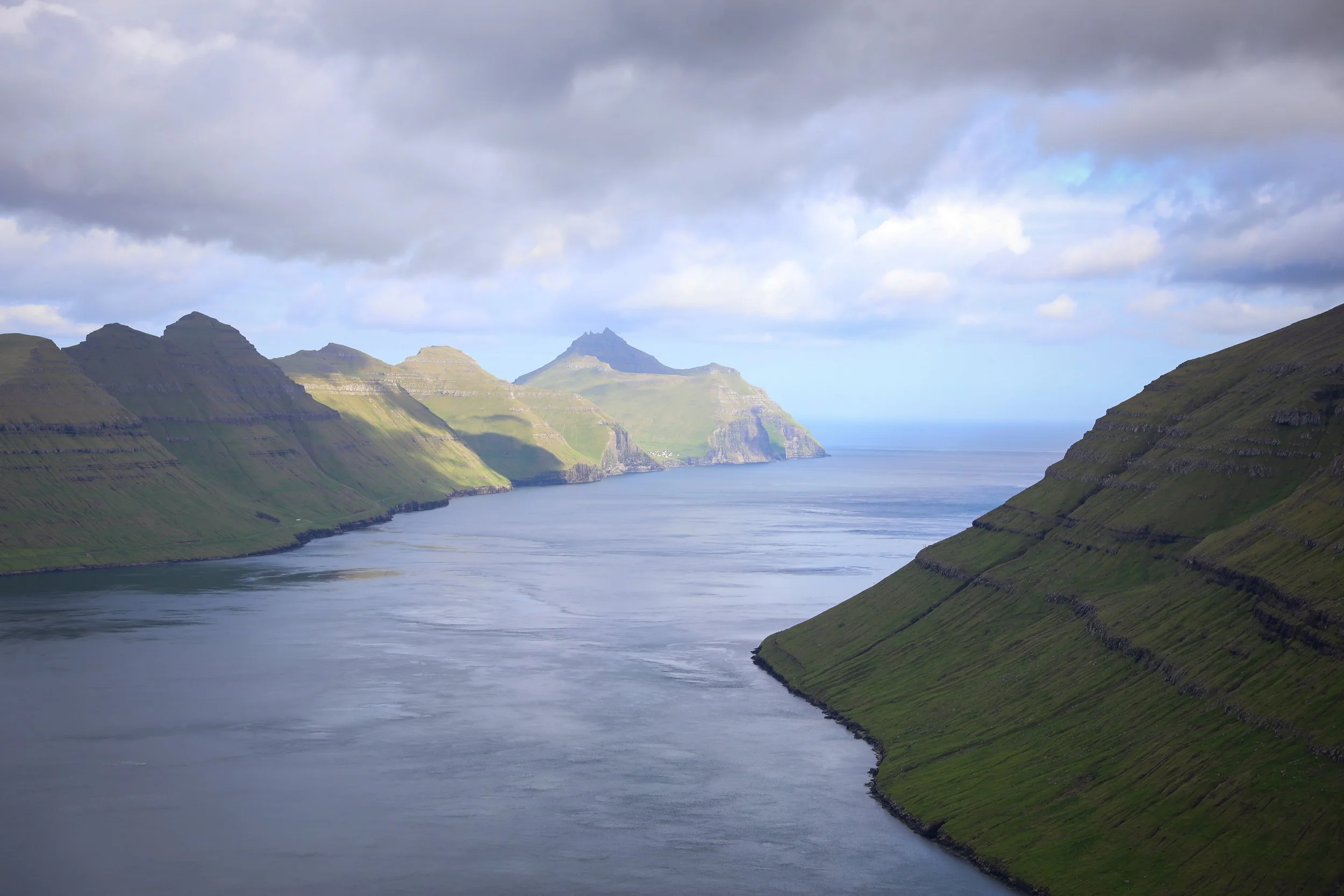
Viewpoint - End of Hike Mount Mýlingur
Mýlingur Hike Overview
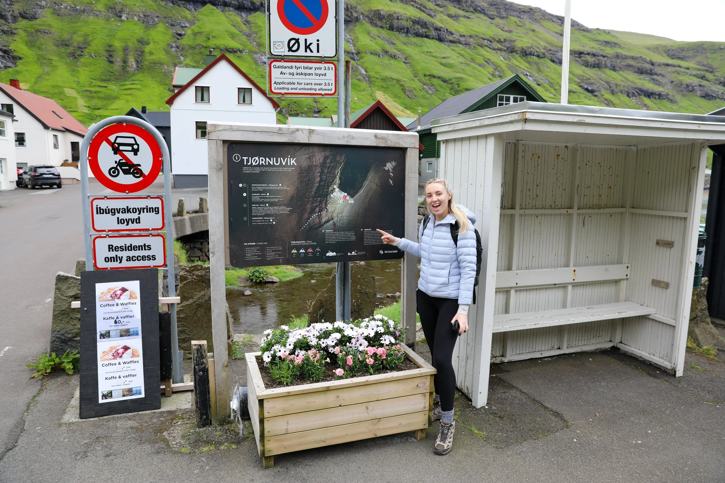
Trailhead: Follow signs from Tjørnuvík small townsite “Saksun Trail” |Google Maps
Parking:Town center free parking |Google Maps
Total Hiking Distance: 14 km
Total Hiking Duration: 2.5 hour hike | one way
Difficulty: Moderate
Altitude: 565 meters above sea level
Price: The hiking trail is free
Highlights:Views over Tjørnuvík fjord, the dramatic black-sand beach, and the legendary sea stacks Risin og Kellingin (the Giant and the Witch) rising from the North Atlantic.
Note: the hike has no official trail
Mýlingur Hike Map
Getting There
From Tórshavn:
Hire Car
All generic hire car companies (Avis, Budget, Europcar) are available from Vágar Airport (Vágar) or Tórshavn city centre (Streymoy)
Car hire costs vary substantially and it is usually one of the most significant costs of a trip to the Faroe Islands so it is best to check and compare prices at the time of booking
The roads are well surfaced the entire way so a 2WD is fine for the journey
The drive takes around 55 minutes one-way to Tjørnuvík
The total distance is around 60 km one-way
Overall a hire car is the best way to get around the Faroe Islands if its within your budget
Public Bus
It is possible to get to Tjørnuvík from Tórshavn via regional bus
This would first involve catching a bus to Oyrarbakki and then an additional bus from there
Note that these are only available on week days and the frequency is fairly sporadic with a bus running only once every few hours
More information can be found on the Strandfaraskip Landsins website including timetables
In general I would not reccomend attempting to use public transport to get there unless you had no time constraints

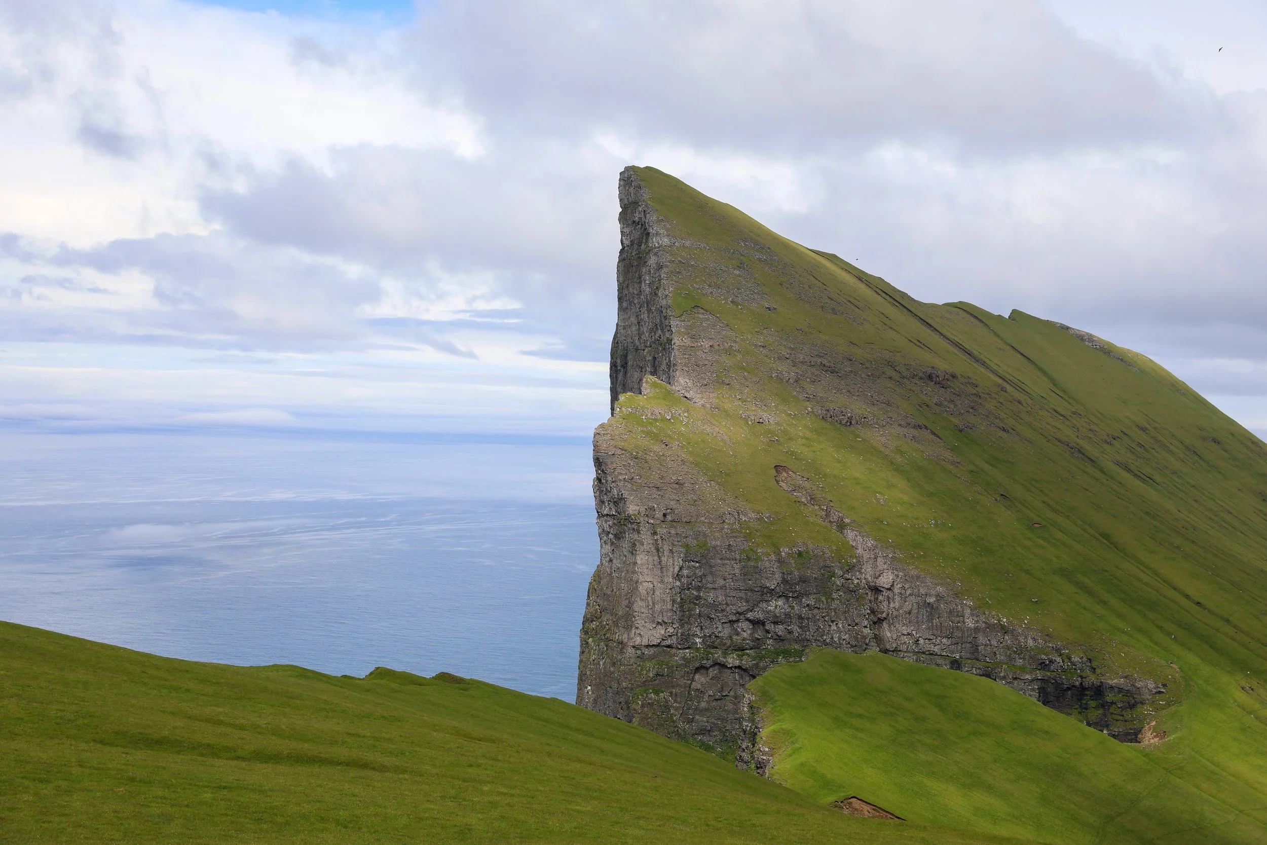
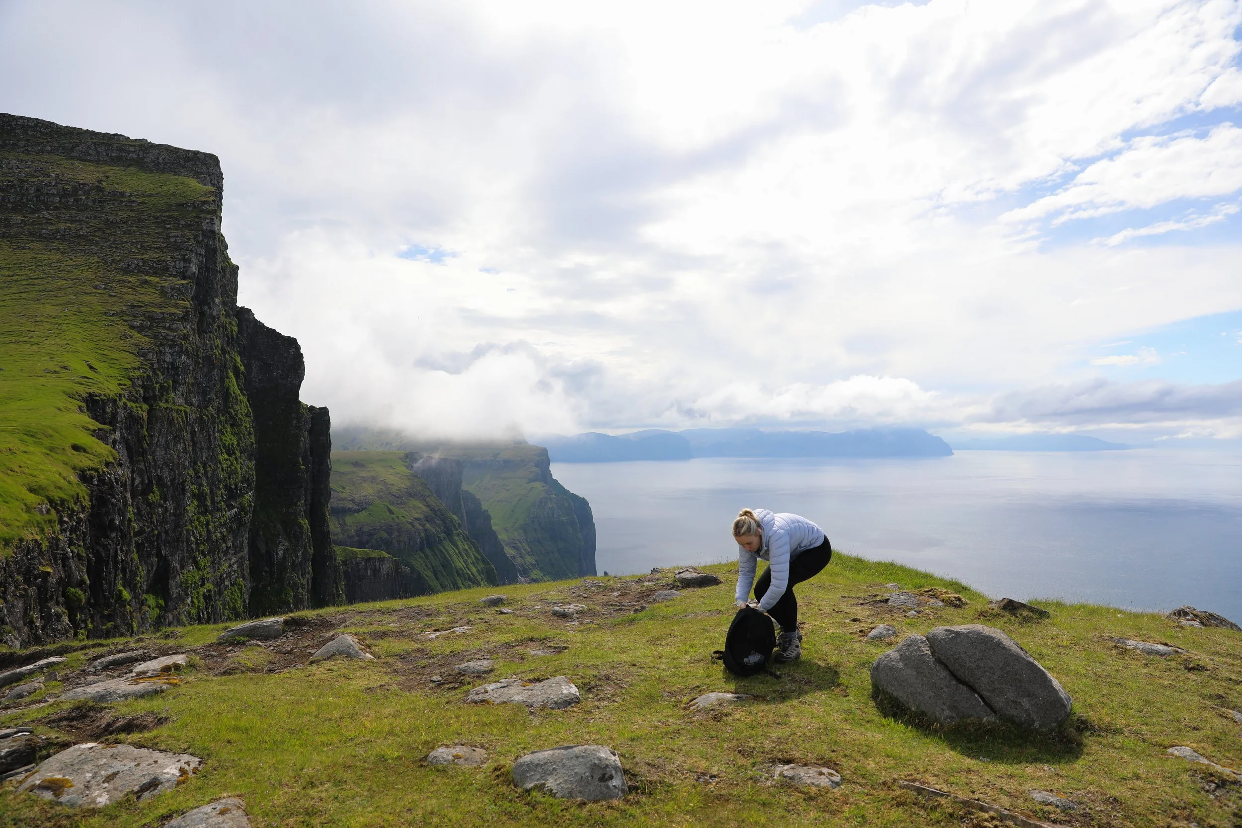
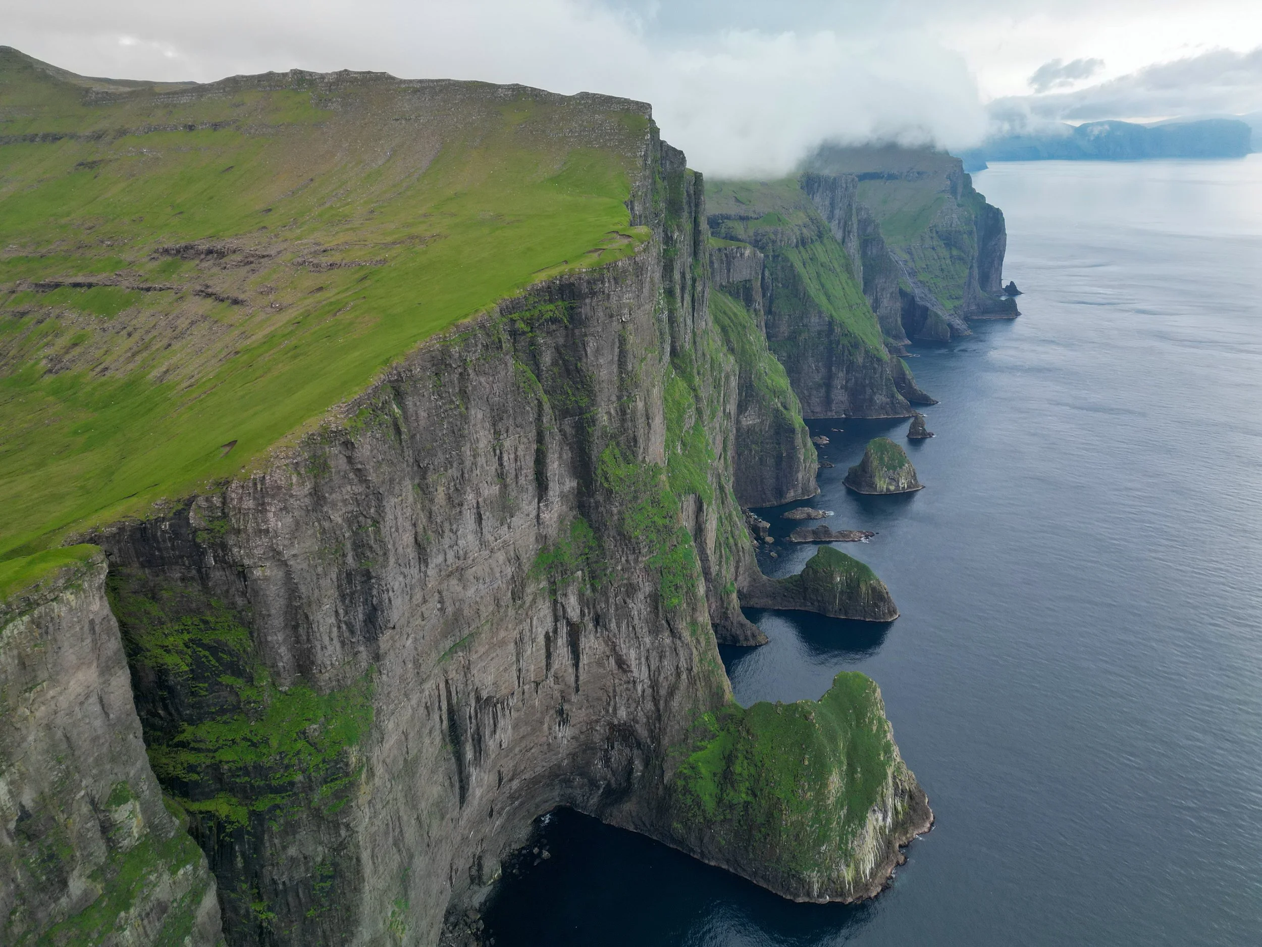
Viewpoint - Mýlingur Sea Cliffs
General Tips
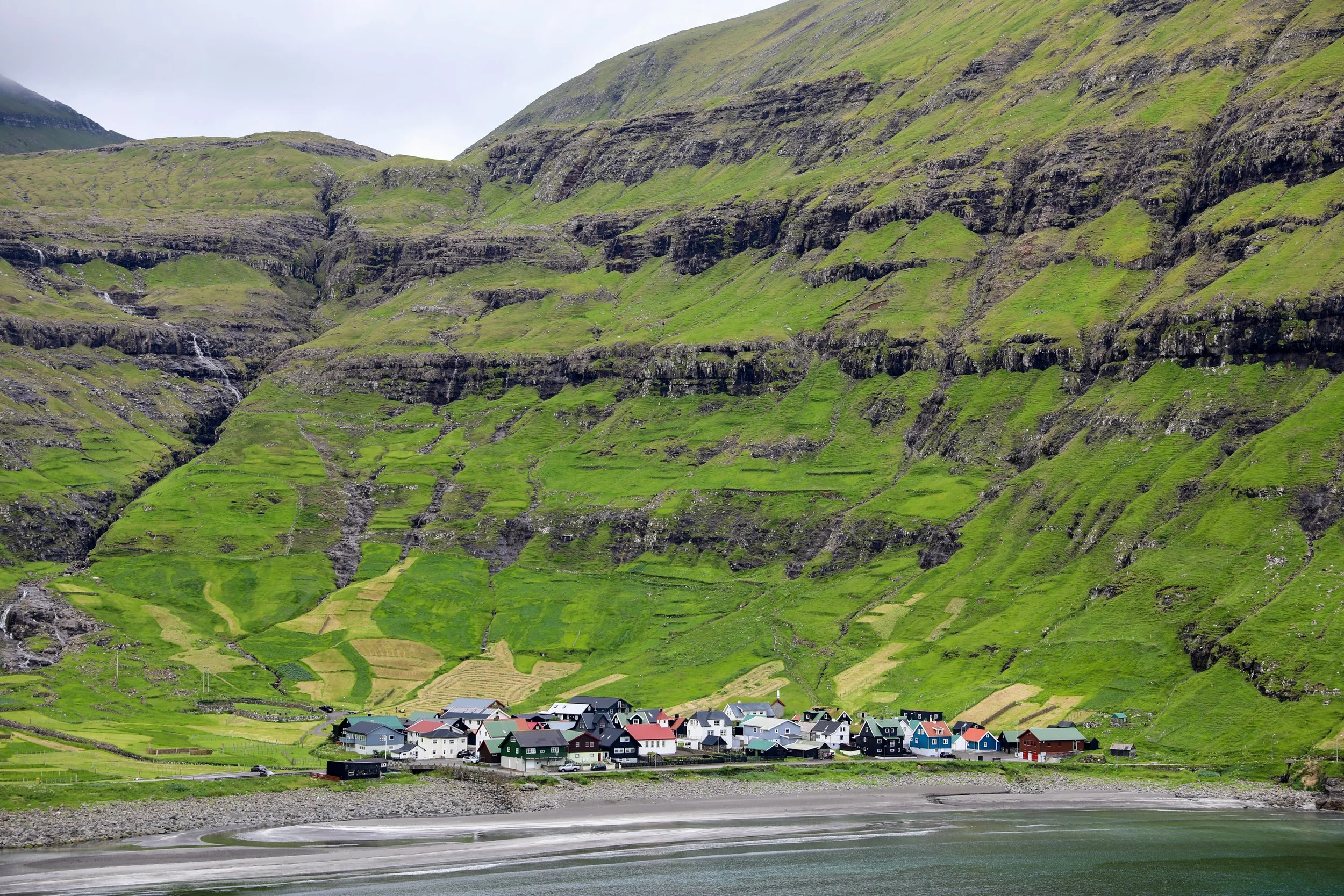
From the parking location in Tjørnuvík there is a sign directing you to the trailhead for the hike to Saksun.
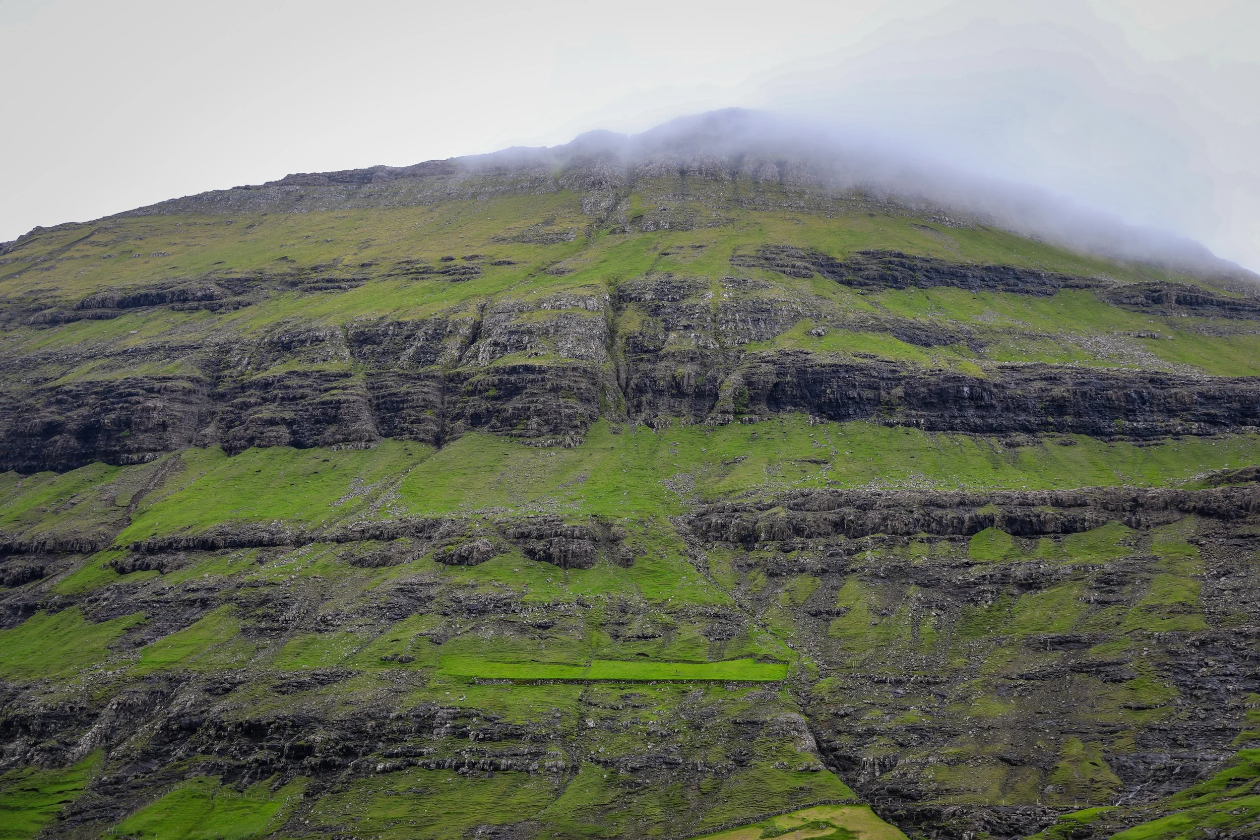
The trail starts off with a fairly steep up-hill section heading out of Tjørnuvík. Through this part the path is fairly well delineated with small signs or coloured rock markings, passing waterfalls and crossing over small streams.
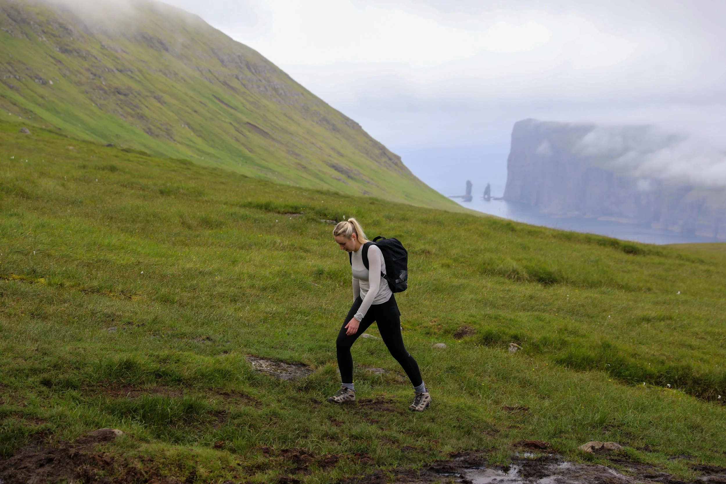
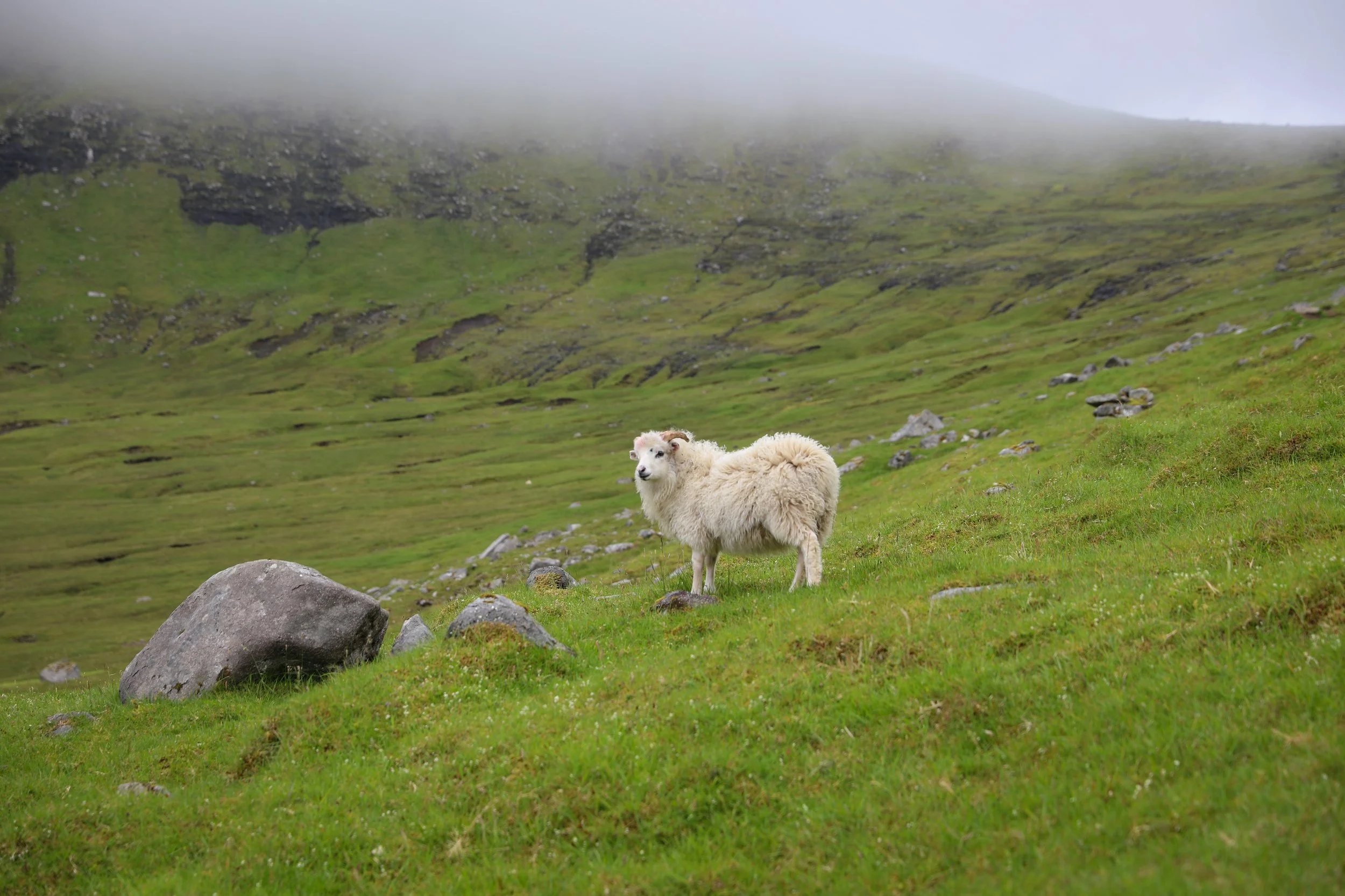
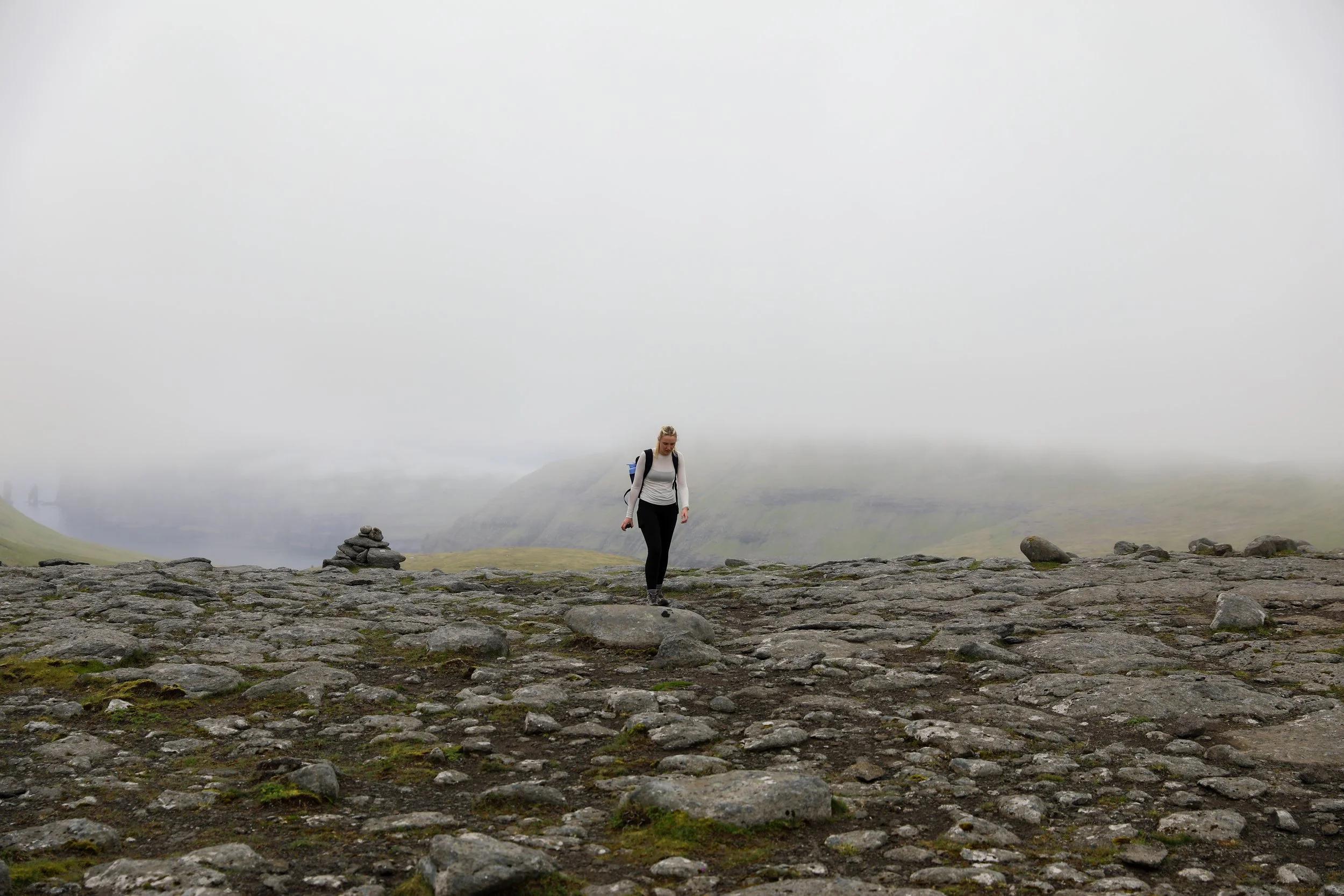
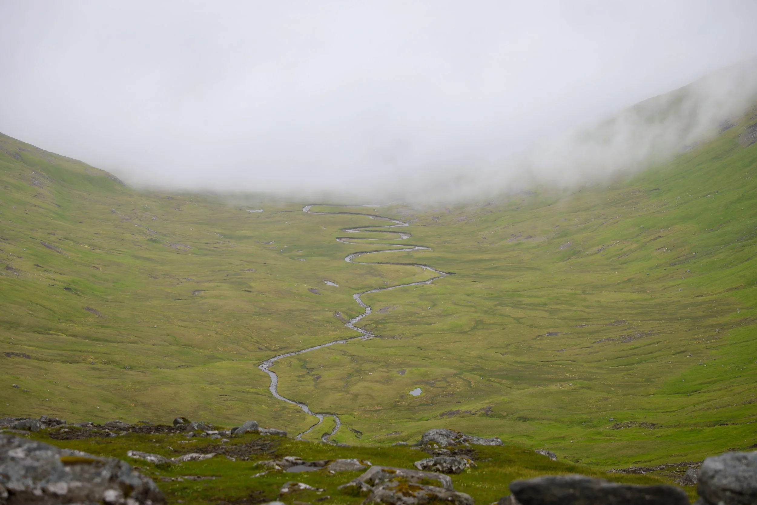
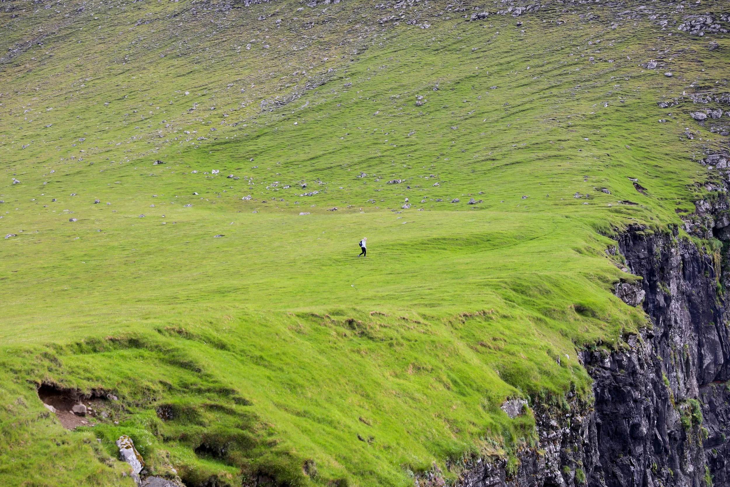
Eventually the trail opens up into a large valley with cairns marking the way up to a ridgeline. Along this section the trail gets extremely muddy so be sure to wear sturdy waterproof footwear.
A cairn marks the top of the saddle where the path splits around 6km in. From here the Saksun hiking trail continues towards the south-east, whilst the unmarked section of the hike begins heading north-west towards Mýlingur.
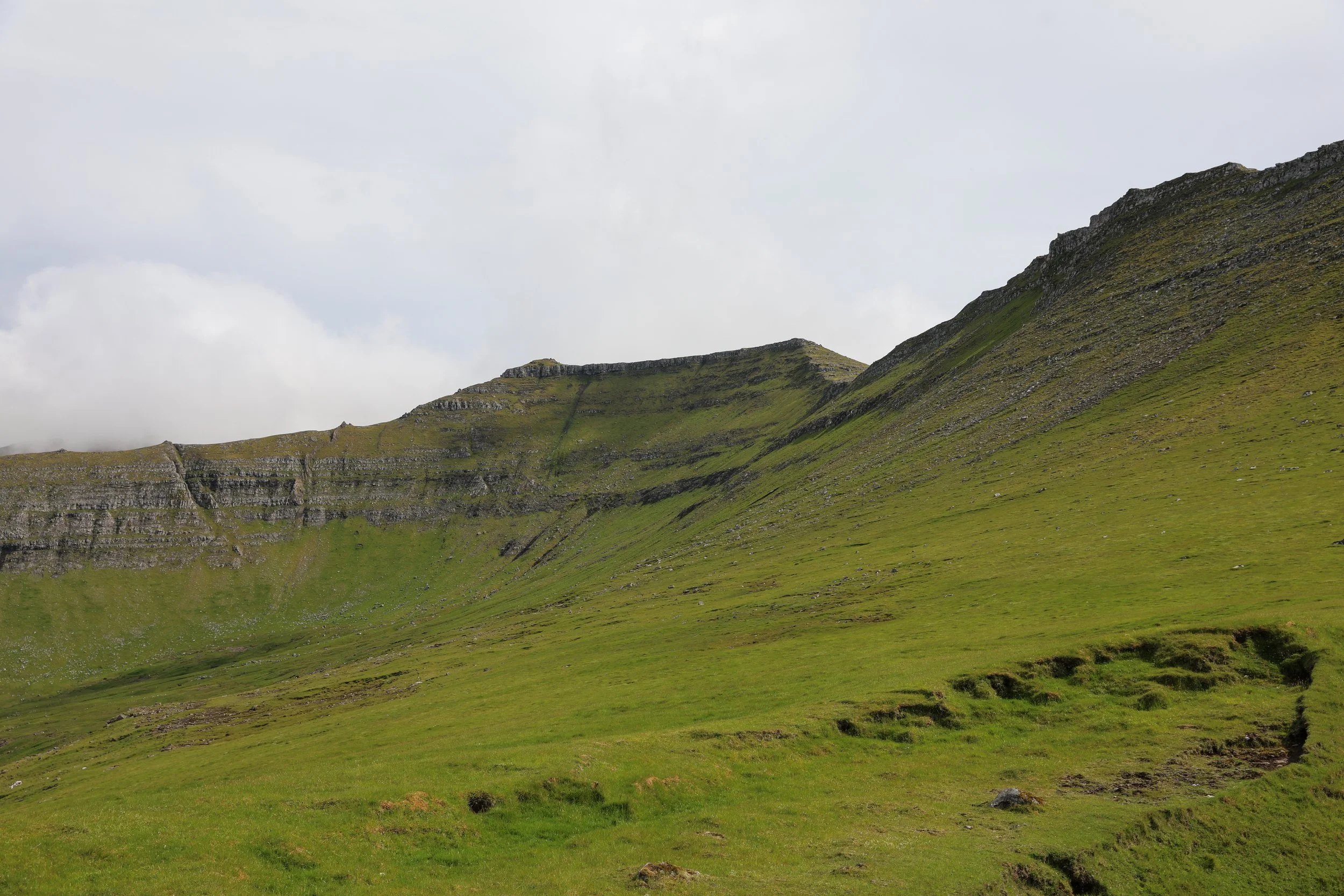
The hike leads progressively up hill until it reaches another ridgeline. At this point there are intial glimpses of the back side of Mount Mýlingur. The ridge can then be followed west for around an hour until there is a visible gap between some rocks heading down to the valley floor.
The hike down the side of the hill is very steep so make sure to take your time and be extra cautious if it has been raining.
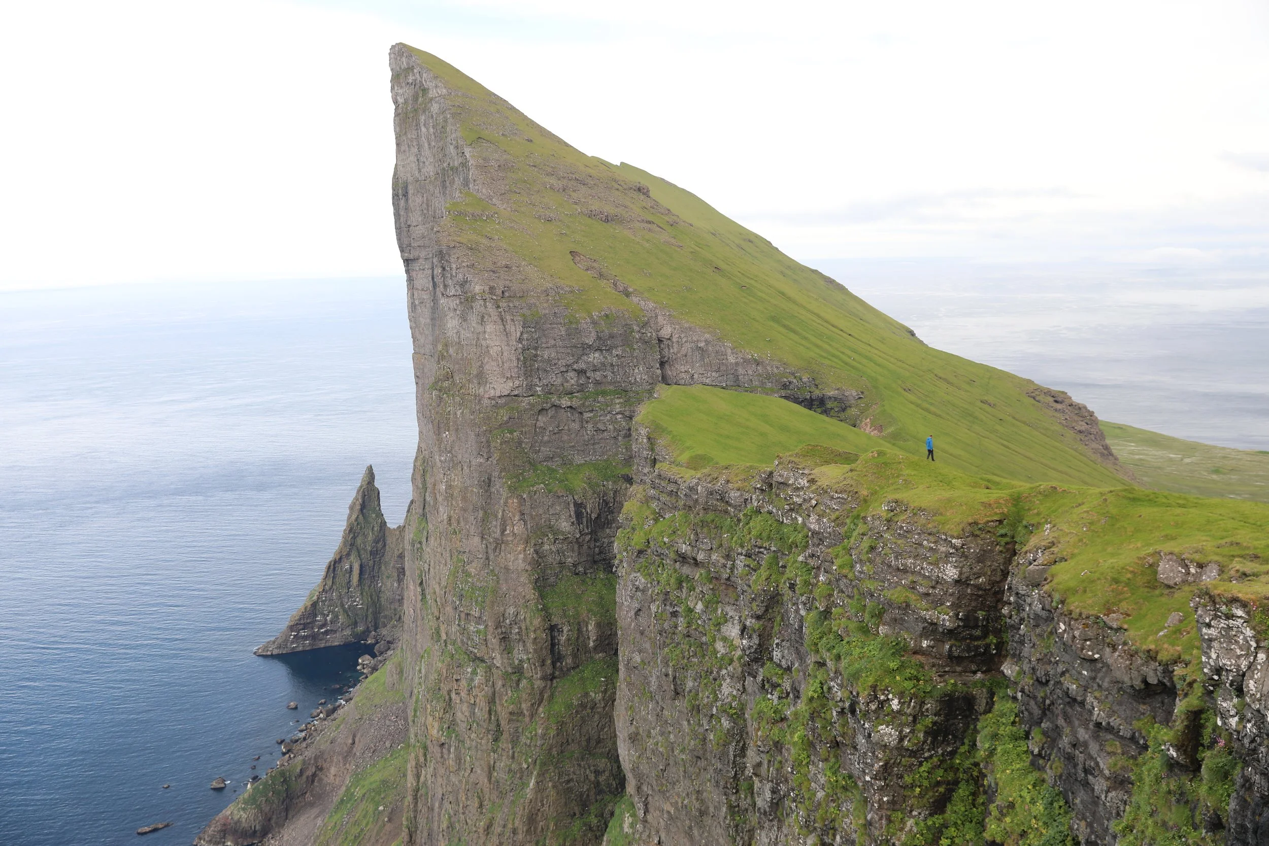
The viewpoints from the bottom are incredible, just be sure not to go near the edge of the 400m high cliffs.
Note that there is no phone reception for the majority of the hike so I would strongly suggest downloading a map of the area in offline Google Maps or using All Trails and having pins set up for the main turning points.
Do not attempt this hike in low cloud, it can become extremely difficult to navigate especially with no marked path.
Ensure you take enough food and water for the duration of the journey as there are no facilities the entire way.
The weather is extremely unpredictable in the Faroe Islands so always prepare for rainfall with a rain/windproof jacket.
View Driving into Tjørnuvík
Tjornuvik Car Park
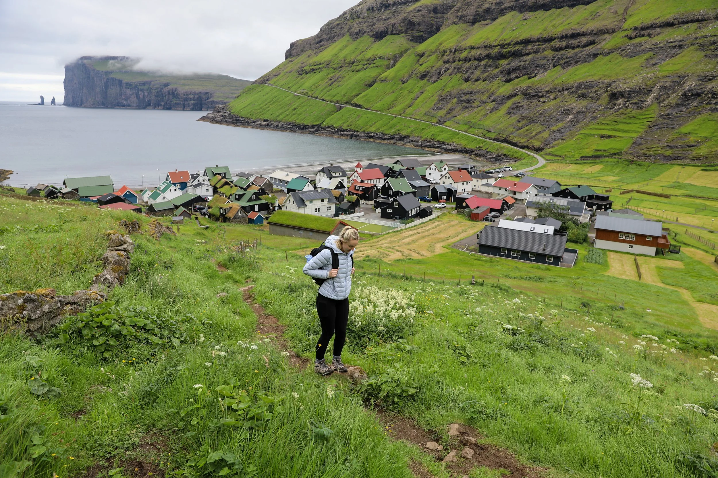
Hike Out of Town
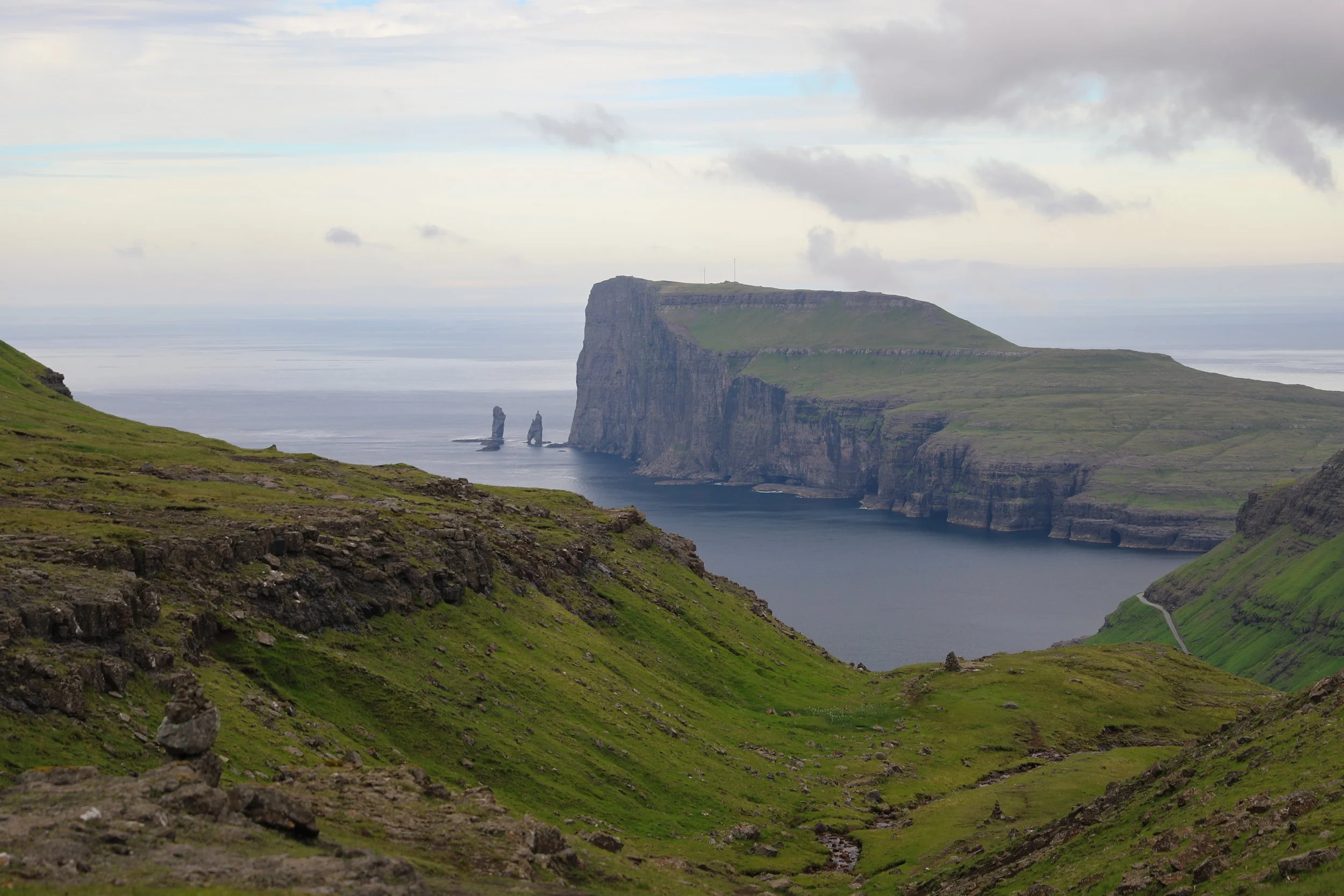
Risin og Kellingin (the Giant and the Witch)
Saddle Turn Off Point to Unmarked Path
Saddle View South
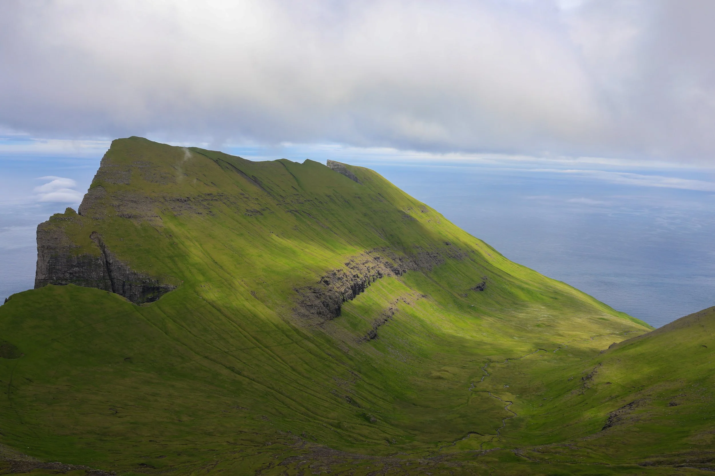
Viewpoint Along Ridgeline Back of Mount Mýlingur
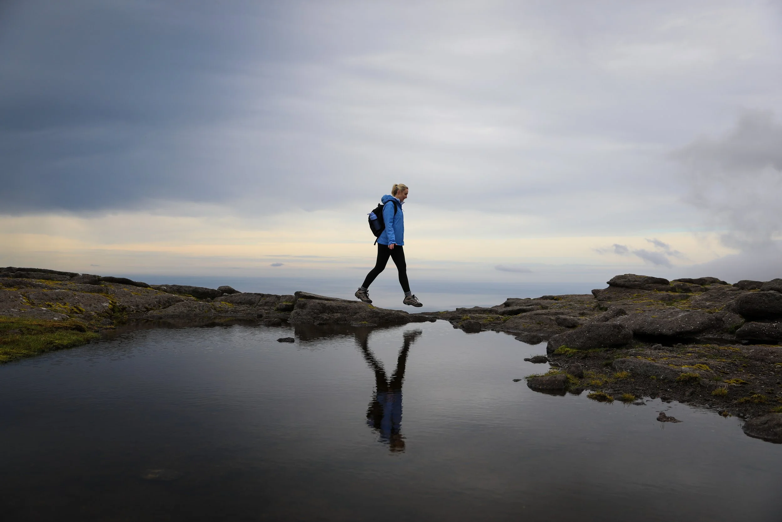
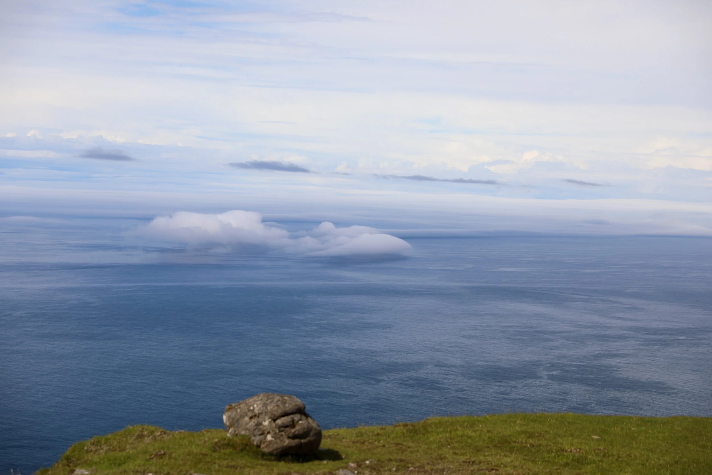
Small Pools of Water On Top of Ridge
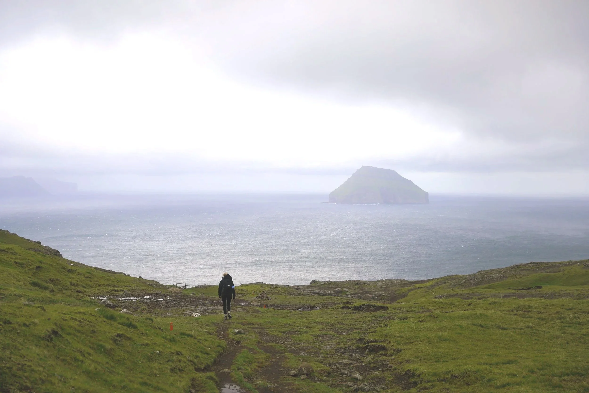
Viewpoint at the Base of the Valley


Viewpoint - End of Hike
Where to Next
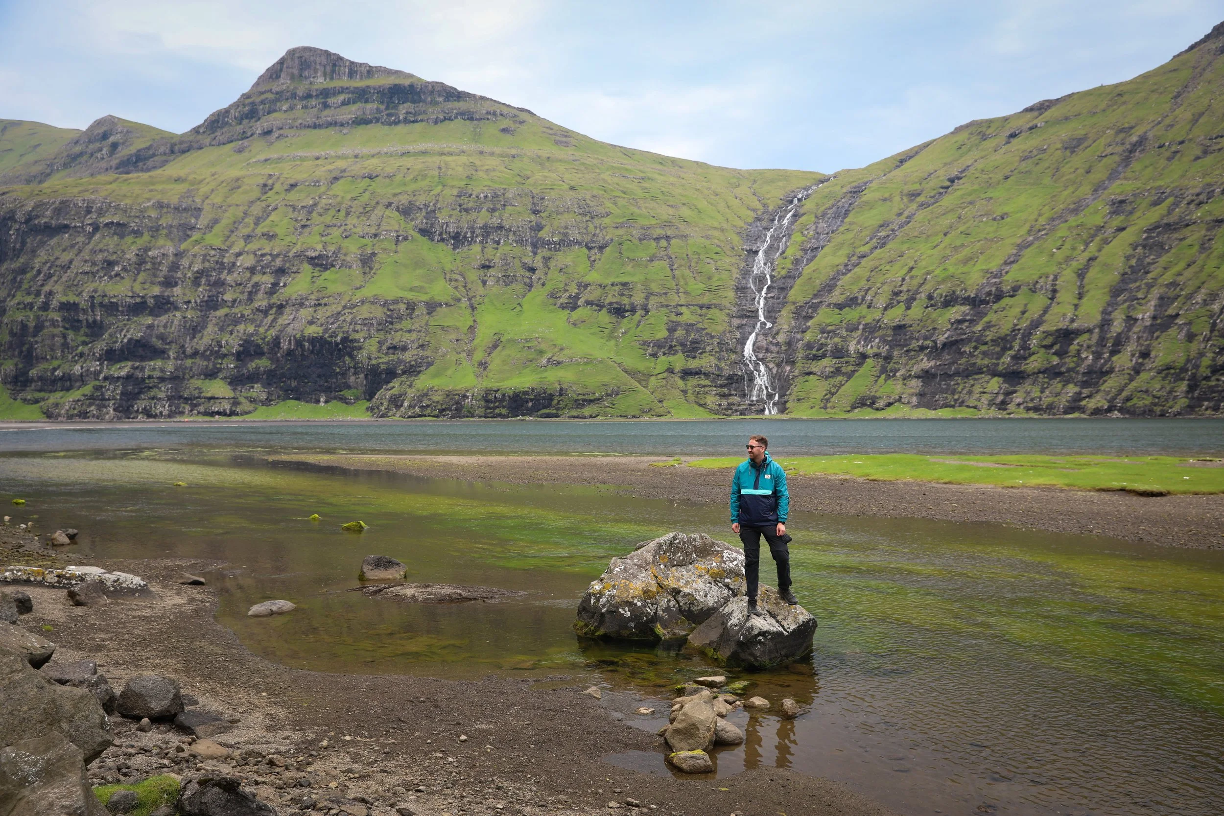
Saksun: approximately a 40 minute drive away from Tjørnuvík is the small town of Saksun. The village is home to a picturesque church overlooking a serene lagoon and a dramatic black-sand beach framed by steep mountains.
Gjógv: about a 50-minute drive from Tjørnuvík is the picturesque village of Gjógv. Its defining feature is a deep sea gorge once used as a natural harbour, with views stretching across the North Atlantic and a cluster of brightly painted houses adding to its charm.
Related Posts:
Perched above the village of Funningur on Eysturoy, the Hvíthamar hike is one of the Faroe Islands’ most accessible yet rewarding walks. The trail gently climbs to a viewpoint overlooking the fjord, with wide-open mountain scenery unfolding at every turn. It’s the kind of short hike that delivers big views, making it a perfect stop for travellers wanting a taste of Faroese hiking without a full-day commitment.