The Ultimate 7-Day Faroe Islands Road Trip Itinerary and Map
Faroe Islands Road Trip
Discover the wild beauty of the Faroe Islands on an unforgettable 7-day self-drive itinerary. Begin on Vágar, chasing dramatic landscapes from the thundering Múlafossur Waterfall and the sculpted Drangarnir sea stacks to the optical illusion of Lake Leitisvatn hovering above the Atlantic. Venture offshore to Mykines for puffins and sweeping ocean views, then explore rugged coastal formations like Trøllkonufingur. Cross to Streymoy to wander the grass-roofed village of Saksun and tackle the remote Mýlingur Hike, before heading north to Borðoy and settling into Klaksvík. From here, journey to Kalsoy to hike to the iconic Kallur Lighthouse, perched high above sheer cliffs and endless sea, a fitting finale to one of the world’s most dramatic island road trips.
Overview:
Day 1 - Múlafossur Waterfall and Drangarnir Sea Stacks Hike
Day 2 - Lake Leitisvatn Hike and Trøllkonufingur
Day 3 - Mykines Island Puffin Hike, Saksun Church and the Black Sand Beach
Day 4 - Tjørnuvík and Mýlingur Sea Cliffs Hike
Day 5 - Gjógv Village, Hvithamar Hike and Elduvík
Day 6 - Kalsoy Island and Kallur Lighthouse Hike
Day 7 - Klakkur Hike and Tórshavn
General Tips for Travelling in Faroe Islands
-
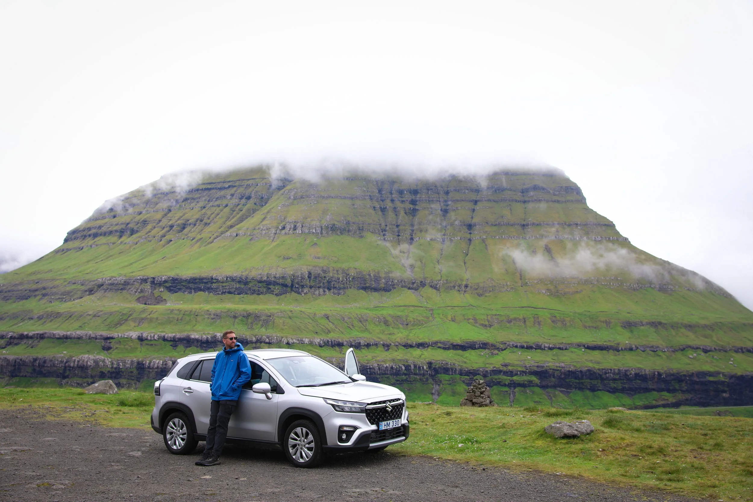
Hiring a car is the best way to get around the Faroe Islands. With many options available at the airport in Vagar.
Book your rental vehicle well in advance as they will book out.
Most car rental companies require the driver to be at least 20 years old with some even requiring the driver to be 23 or 25. You will need a valid drivers licence and an international licence is recommended.
Make sure that you are adequately insured before departing.
A 2WD vehicle will suffice given there are sealed roads throughout the islands.
In the Faroe Islands they drive on the right hand side of the road.
Fuel is an extremely costly part of your road trip itinerary so try and make sure you pick an economical car. Fuel stations are plentiful with many 24/7 self-serve bowsers setup in remote areas.
-
Due to the varying climate the best time to travel is typically through the peak of summer between mid-July and the end of August. Although this period is the busiest tourist wise it has the most favourable weather and ensures that all roads and hiking trails are open.
Book your accommodation (6 months) well in advance to ensure you can get into desirable locations and avoid price hikes. A lot of the smaller towns have extremely limited options.
I would suggest booking tickets for guided hikes or tours well in advance as they can book out. The same applies to hire cars.
Be flexible with your planning of days given that the weather can change at short notice.
-
The Faroe Islands overall are quite small, so its fairly easy to just base yourself in a couple of different towns and do day trips from there. The main hubs tend to be around Sørvágur on Vagar, Torshavn on Steymoy, Gjogv on Eysturoy and Klaksvik on Bordoy.
Outside of these areas finding accomodation can be extremely difficult.
Note that this itinerary primarily caters tothose who want to see as much as possible in limited time.
I find planning accomodation through Booking.com to be the most convenient way. The map feature makes it easy to look at the proximity of accomodation to major towns and attractions.
If possible find accomodation with kitchen facilities this is a great way to save money.
-
The Faroe Islands is extremely expensive on all fronts, including accomodation, food and transport. Note that they use the Danish Króne (DKK).
If you want to try and save money and are on a budget, a great tip is to purchase food from supermarkets like Bonus and then have picnics along the way. It doesn’t only save you money but encourages more time outdoors. Also if the accommodation has kitchen facilities make sure you take advantage of these.
Clean drinking water is readily available at nearly all major landmarks so make sure you keep a water bottle that you can refill as you go.
Booking in advance will increase your chances when it comes to securing cheaper accommodation and car hire options.
Travel with multiple people if possible, splitting the costs of a hire car or accommodation can reduce your overall spend substantially.
-
Public taps with clean drinking water are available practically everywhere so make sure to take a reusable bottle with you.
Bring well worn reliable runners / hiking shoes that are comfortable to wear for long periods of the day.
Always bring a rain jacket in your back pack as the conditions within the mountains can change frequently and without warning.
Make sure to take your camera or empty your phone storage prior to arriving.
The temperature in summer typically ranges between 10°C and 15°C with nearly 24 hours of sunlight. However this temperature can fluctuate dramatically especially with the onset of rain. Ensure that you pack a warm jacket, hiking pants, and multiple layers.
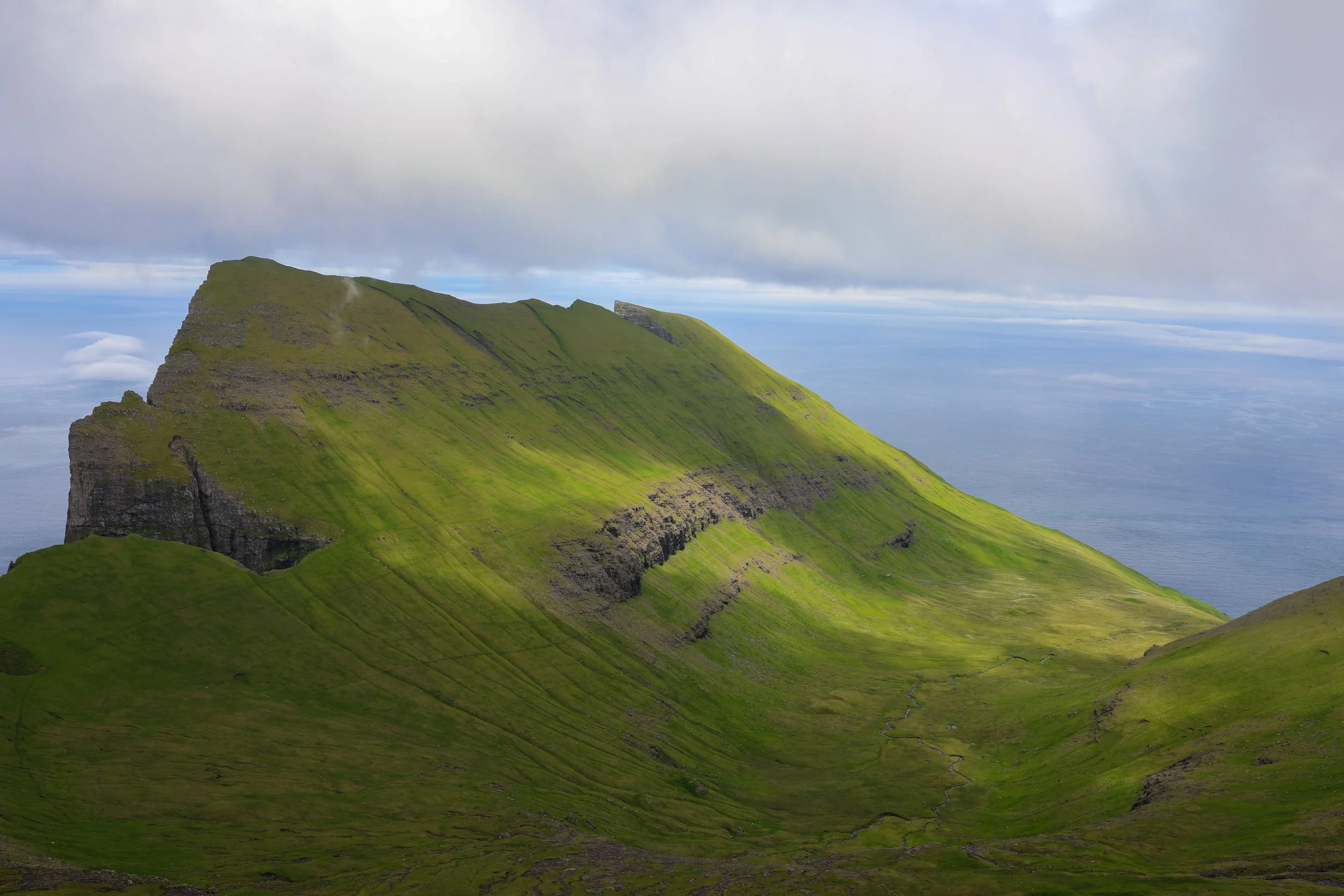
Mýlingur Sea Cliffs Hike
Day 1: Múlafossur Waterfall and Drangarnir Sea Stacks Hike
Summary: Depart from Vágar Airport and drive to Múlafossur Waterfall, a spectacular 30-metre-high cascade that plunges directly into the North Atlantic Ocean. Continue 20 minutes to Sørvágur, the meeting point for a guided hike to the iconic Drangarnir Sea Stacks, where a short boat ride is followed by a one-hour ridge hike with dramatic views over Stóri Drangur and Lítli Drangur.
Total Driving Distance: 20 km
Total Driving Duration: 30 minutes
Accomodation: stay in Sørvágur
Highlights: visit Múlafossur Waterfall, and hike along the coast of Vágar island to the Drangarnir Sea Stacks
Day 1 Overview:
Múlafossur Waterfall
Depart: Vágar Airport I Google Maps
Arrive: Gásadalur I Google Maps
Drive Distance: 18 km drive
Drive Duration: 20 minutes
Cost: Free entry
Activity Duration: 1.5 hours
The Múlafossur Waterfall plunges around 30 metres from the cliffs of Gásadalur directly into the North Atlantic Ocean.
Its dramatic seaside setting makes it one of the Faroe Islands’ most unforgettable natural landmarks.
Múlafossur Waterfall
Drangarnir Sea Stacks Guided Hike
Depart: Gásadalur I Google Maps
Arrive: Sørvágur I Google Maps
Drive Distance: 10 km drive
Drive Duration: 15 minutes
Cost: Tour cost is 800 DKK per person
Activity Duration: 3 hours
Operators: The only permitted access to Drangarnir is via an organised tour which can be booked on the Hiking FO website
Time: The tour only runs on Wednesday, Saturday and Sunday at 10:00AM, 12:30PM or 14:00PM between the start of April and the end of September
Hike Details
Total Hiking Distance: 5 km | one-way
Total Hiking Duration: 1 hour hike | one-way
Difficulty: Moderate
Altitude: 220 meters above sea level
The Drangarnir Sea Stacks Guided Hike starts off by meeting at the main jetty in Sørvágur, from here you will be provided a lifejacket and board a small rib boat which will transfer you to the start of the hike.
The hike passes through private property and it is therefore forbidden to attempt to do the hike without an organised tour which includes a local guide.
The group size is a maximum of 16 people so its not super overcrowded.
Note that you are not allowed to fly drones at the sea stack site to protect nesting birds.
The entire hike can get extremely muddy and most of it is onmarked trails so be sure to wear sturdy waterproof footwear.
Next: The tour brings you back to Sørvágur which is where I would recommend basing yourself in Vágar
Drangarnir Sea Stacks
Day 2: Lake Leitisvatn Hike and Trøllkonufingur
Summary: Depart from Sørvágur and start your day by hiking around Lake Leitisvatn, made popular by its striking optical illusion that makes it appear to float above the Atlantic Ocean. From here, enjoy a short drive to the village of Sandavágur, where a brief hike leads to Trøllkonufingur, an impressive towering sea stack known as “the Troll Woman’s Finger,” rounding out a day shaped by Faroese folklore, dramatic coastal scenery, and the ever-present power of the ocean.
Total Driving Distance: 20 km
Total Driving Duration: 30 minutes
Accomodation: stay in Sørvágur
Highlights: seeing the impressive Lake Leitisvatn, and hiking to the Trøllkonufingur view point
Day 2 Overview
Lake Leitisvatn
Depart: Sørvágur I Google Maps
Arrive: Lake Leitisvatn I Google Maps
Drive Distance: 9 km drive
Drive Duration: 11 minutes
Activity Duration: 3 hours
Cost: Entry cost is 200 DKK
Hike Details
Total Hiking Distance: 6 km | round-trip
Total Hiking Duration: 2.5 hour hike | round-trip
Difficulty: Easy
Altitude: 142 meters above sea level
Lake Leitisvatn is the largest lake in the Faroe Islands, renowned for its striking optical illusion that makes it appear suspended above the Atlantic Ocean, framed by sheer basalt cliffs, sweeping emerald hills, and the distant surge of waves plunging over the Bøsdalafossur waterfall.
The hike passes through private property and it is therefore forbidden to attempt to do the hike without paying for entry.
The hiking trail is well marked leading towards the cliff area.
Snorkelling in the Silfra Fissure
Trøllkonufingur
Depart: Lake Leitisvatn I Google Maps
Arrive: Sandavágur I Google Maps
Drive Distance: 5 km drive
Drive Duration: 10 minutes
Cost: Entry cost is free
Activity Duration: 2 hours
Hike Details
Total Hiking Distance: 3 km | round-trip
Total Hiking Duration: 20 minute hike | one-way
Difficulty: Easy
Altitude: 313 meters above sea level
Trøllkonufingur, meaning “the Troll Woman’s Finger,” is a towering sea stack in the Faroe Islands that captivates visitors with its sheer vertical form and folklore-laden presence, rising starkly from the North Atlantic
Enusre that you stay within the fenced boundaries and shut gates when required to prevent sheep from getting out.
Next: After your time at Trøllkonufingur its a 15 minute drive back to Sørvágur
Trøllkonufingur Hike
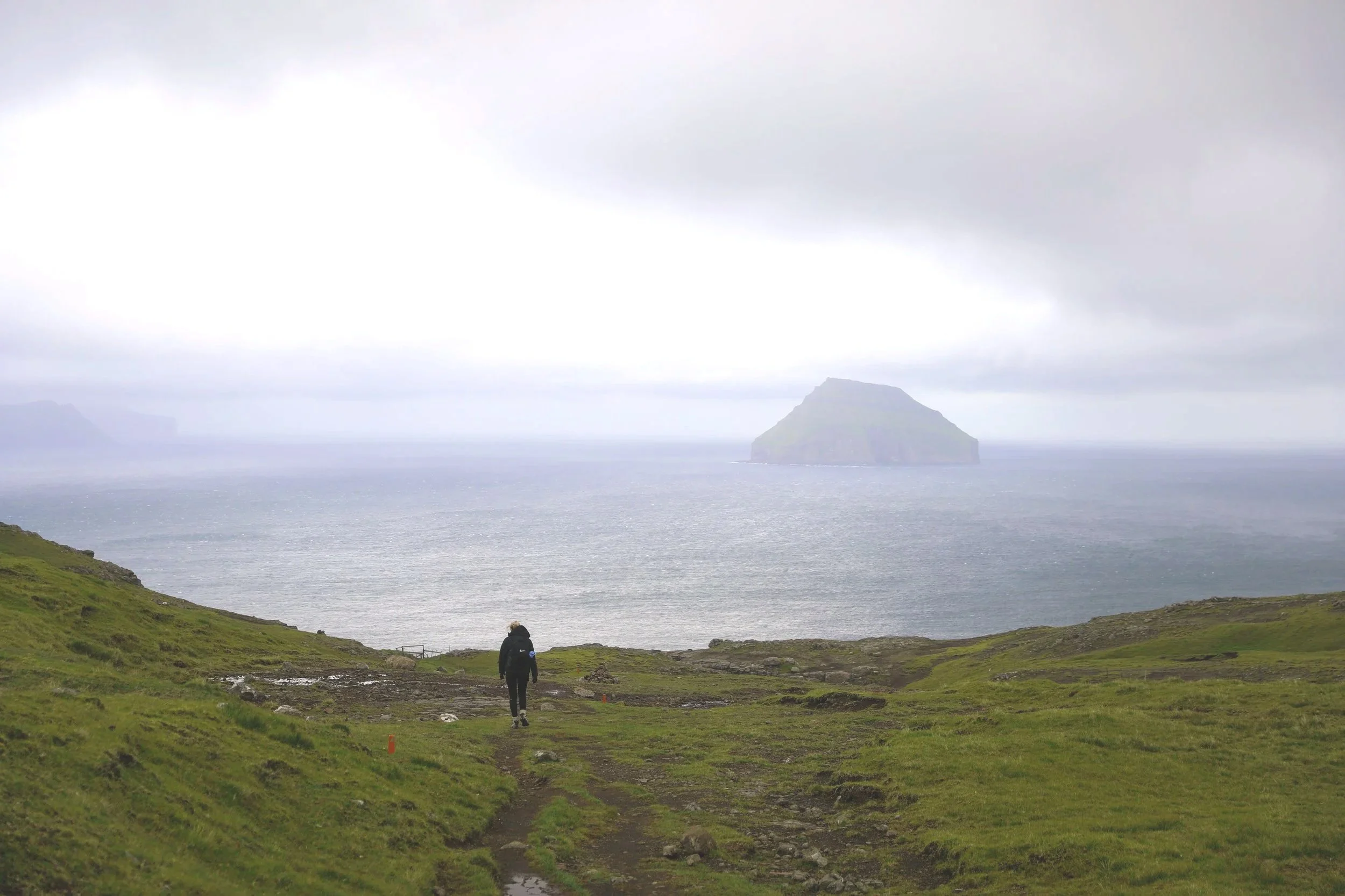
Day 3: Mykines Island Puffin Hike, Saksun Church and the Black Sand Beach
Summary: Meet at the ferry port in Sørvágur to begin your journey to the mystical island of Mykines. Upon arrival, meet your guide and set out on a short guided hike, keeping watch for puffins along the cliffs and grassy slopes. After returning to Sørvágur, continue your drive from Vágar to the island of Streymoy, stopping at the historic village of Saksun, where you can visit the iconic Saksun Church and stroll along its striking Black Sand Beach.
Total Driving Distance: 93 km
Total Driving Duration: 1.5 hours
Accomodation: Gjógv
Highlights: spotting puffins on the island of Mykines and visiting Saksun Church and the Black Sand Beach.
Day 3 Overview:
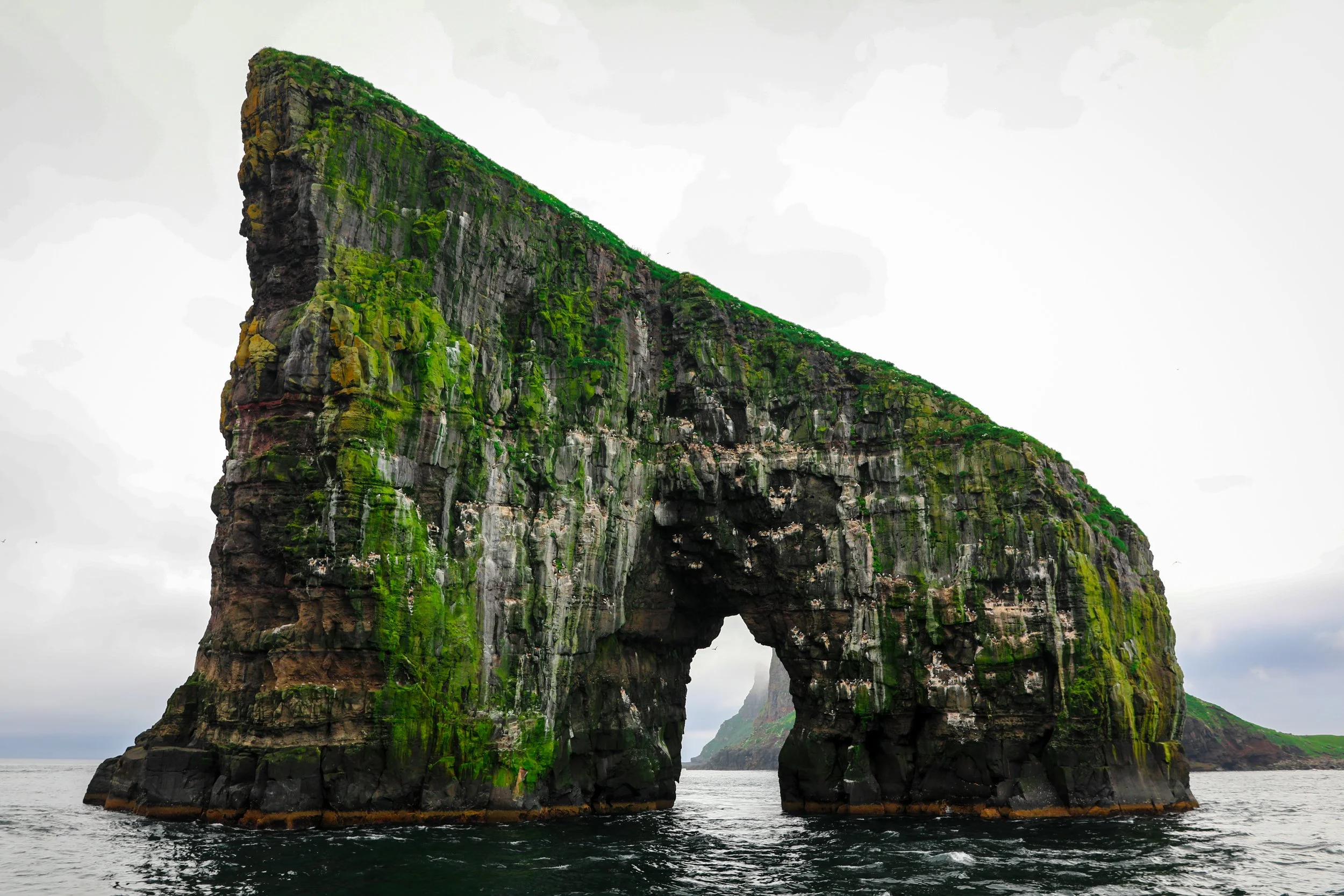
Mykines Island Puffin Hike
Depart: Sørvágur I Google Maps
Arrive: Sørvágur Port I Google Maps
Drive Distance: 1 km drive
Drive Duration: 5 minutes
Operators: In order to see the Puffins on Mykines it is mandatory to book an organised tour via the Hiking FO website. Note that this must be booked seperately to the ferry ticket which only allows access onto the island.
Ferry Schedule: There are two departure times during the summer season of 9:30 AM or 15:30 AM | Ferry Timeable
Tour Price: Tour cost is 400 DKK per person
Ferry Price: The ferry is approximately 120 DKK per adult for a return trip
Activity Duration: The activity goes for 3 hours
Tour Time Slots: Tours run twice daily, aligning directly with the ferry departures
The Mykines puffin experience is an unforgettable wildlife highlight in the Faroe Islands.
The tour first involves an introduction to Mykines town, before commencing a walk up to some lookout points and circling back around to the town center totalling approximately 5 km of walking.
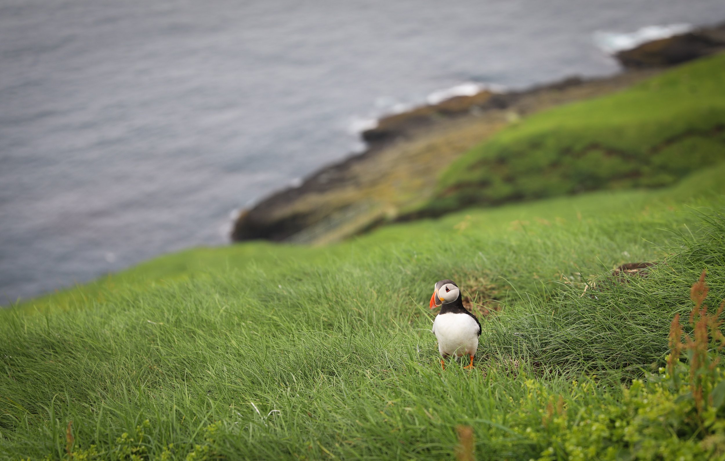
Puffins on Mykines
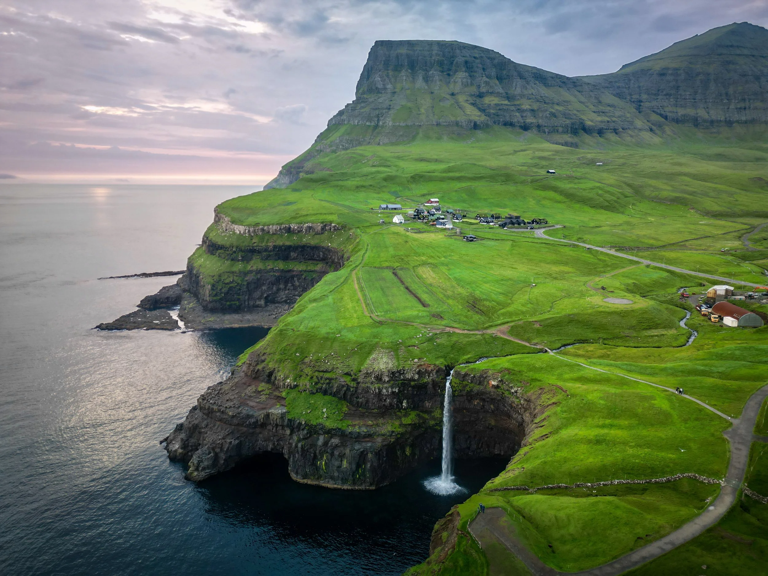
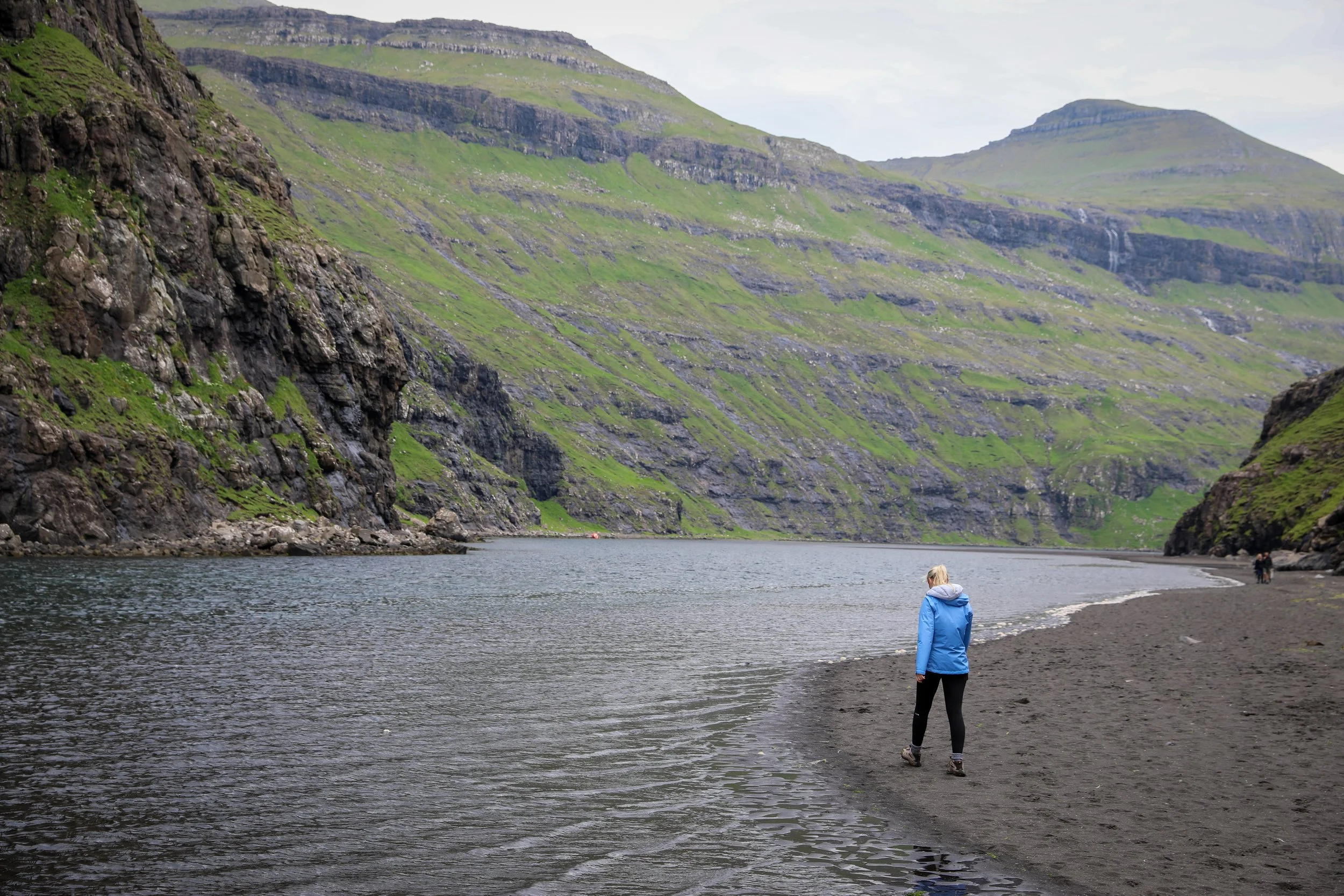
Saksun Church and the Black Sand Beach
Depart: Sørvágur I Google Maps
Arrive: Saksun I Google Maps
Drive Distance: 56 km drive
Drive Duration: 1 hour
Cost: Free entry
Activity Duration: 3 hours
Hike Details
Total Hiking Distance: 2.5 km | one-way
Total Hiking Duration: 40 minute hike | one-way
Difficulty: Easy
Altitude: 50 meters above sea level
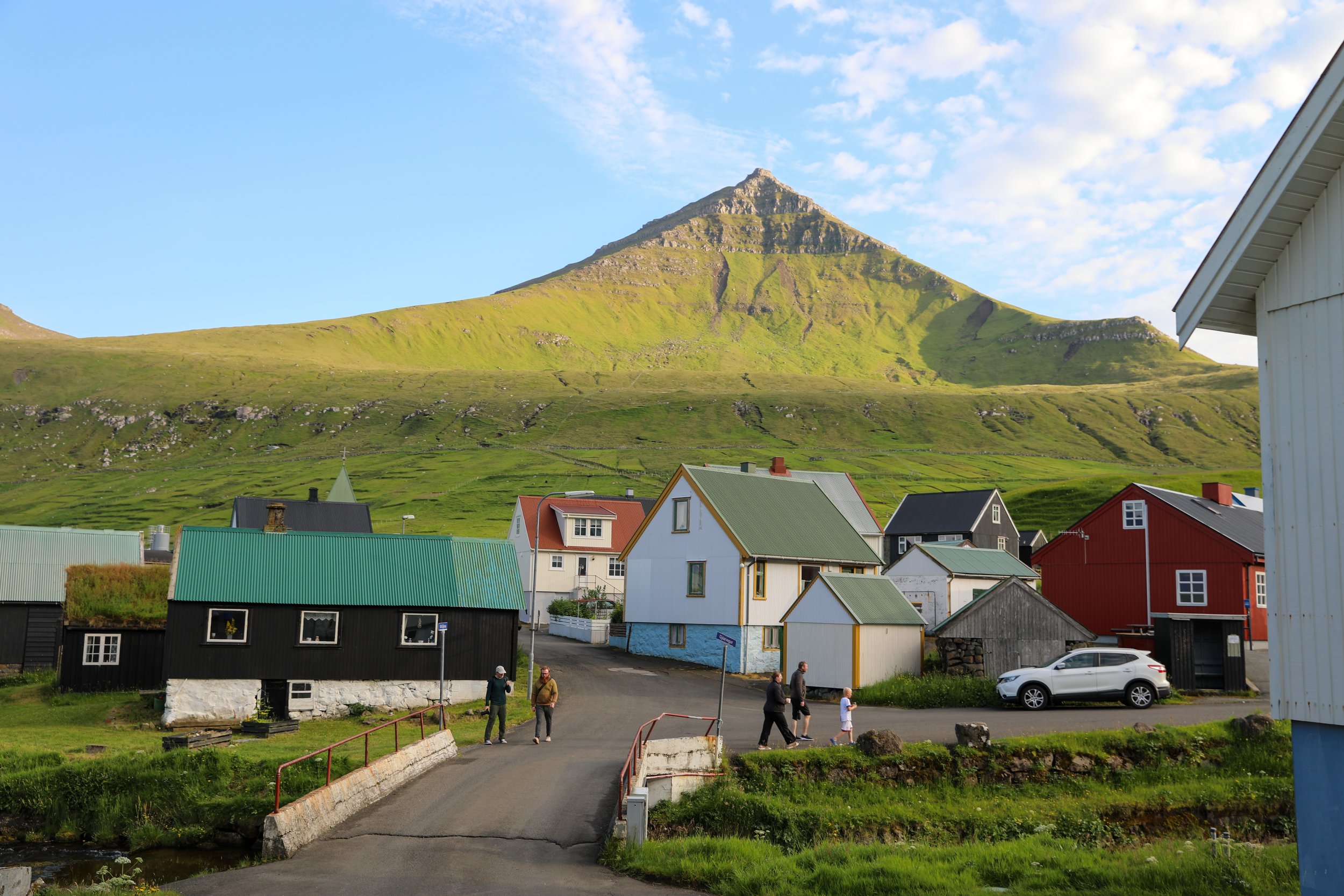
Saksun Church and Saksun Beach are set within a natural amphitheatre of steep mountains in the remote village of Saksun on Streymoy
The small white church overlooks a tidal lagoon formed by a historic storm, and a short walk beyond the village leads to the black sand beach where the lagoon meets the Atlantic
Note that as the name implies, the lagoon is tidal and at certain times of the day it can completely cut off access to the black sand beach
Next: After your time in the town there is a 45 minute drive to Gjógv where I would suggest staying
Saksun Church
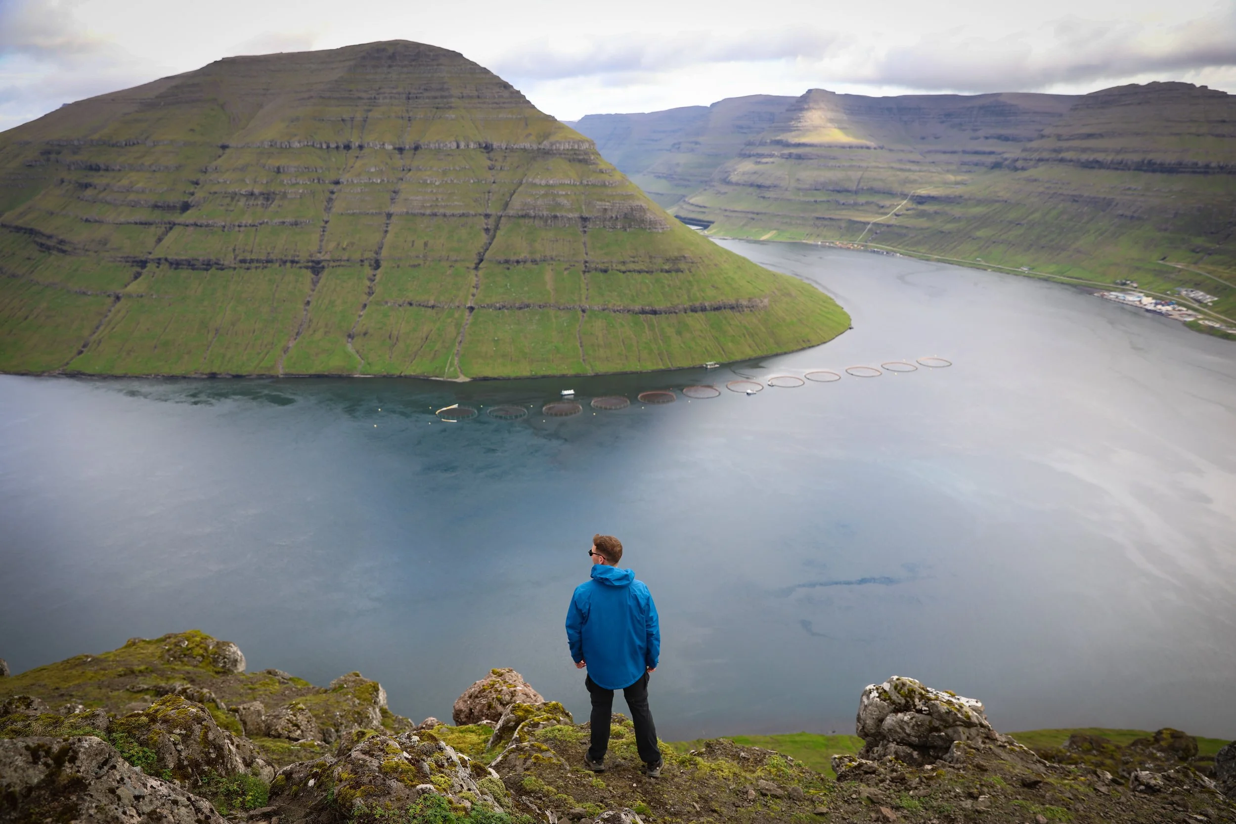
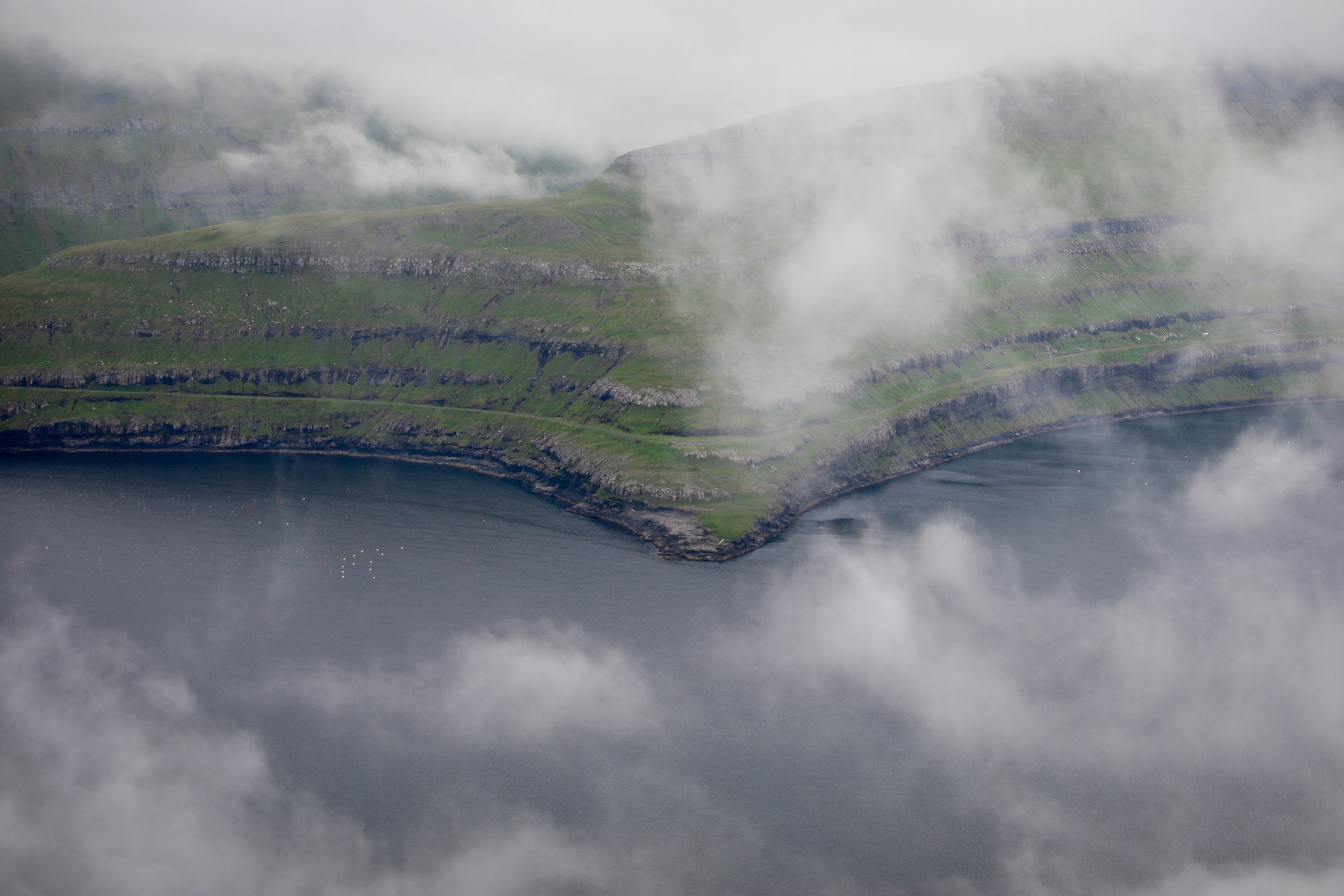
Day 4: Tjørnuvík and Mýlingur Sea Cliffs Hike
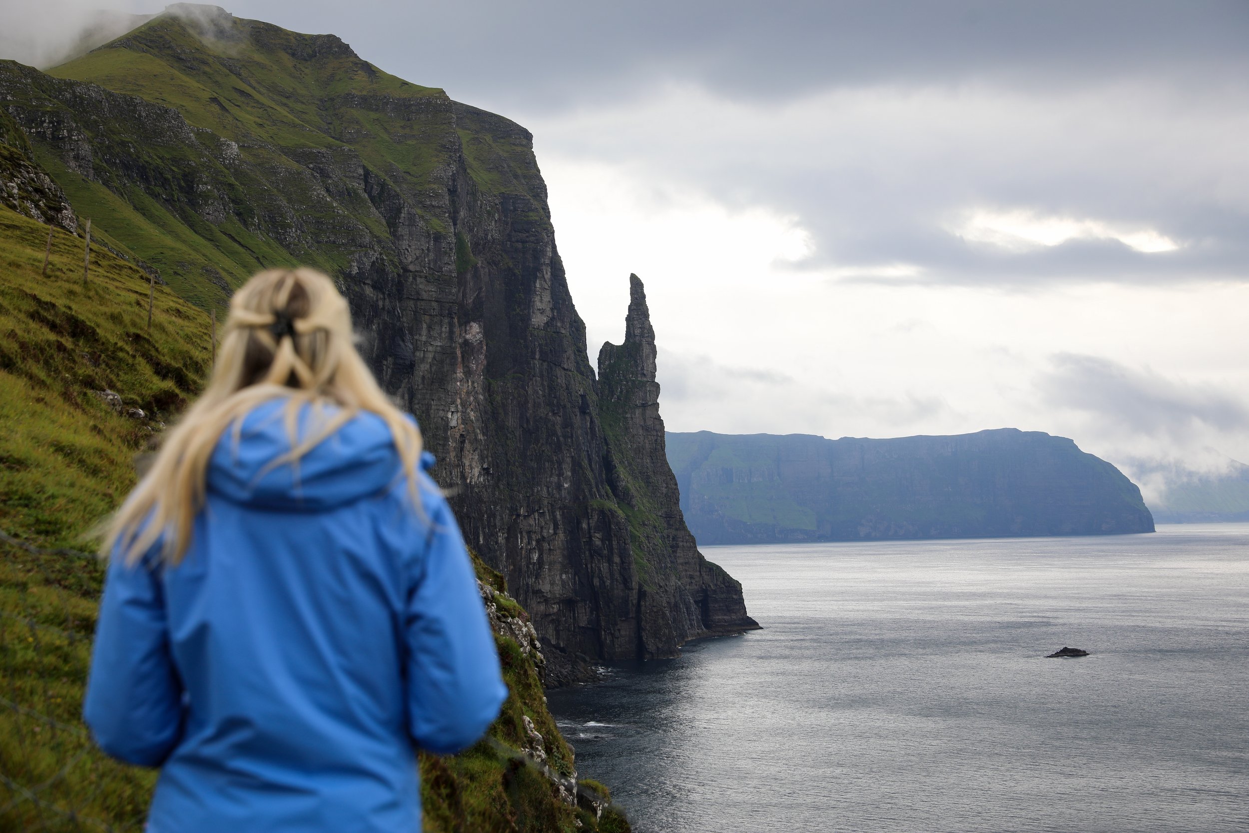
Summary: Depart from Gjógv and enjoy a scenic drive of just under an hour to the quiet village of Tjørnuvík, tucked along the northern coastline of Streymoy Island. From here, set out on an adventurous hike beginning on the historic Tjørnuvík–Saksun trail, where sweeping views of Risin og Kellingin (the Giant and the Witch) dominate the horizon. Leaving the marked path behind, the route then ventures off-track toward the dramatic Mylingur sea cliffs, offering a truly wild and unforgettable experience.
Total Driving Distance: 80 km
Total Driving Duration: 2 hours
Accomodation: Gjógv
Highlights: Visit the remote village of Tjørnuvík, take in views of the iconic Risin og Kellingin sea stacks, hike part of the historic Tjørnuvík–Saksun trail, and venture off-track to the dramatic Mylingur sea cliffs.
Day 4 Overview:
Mýlingur Sea Cliffs Hike
Depart: Gjógv I Google Maps
Arrive: Tjørnuvík I Google Maps
Drive Distance: 38 km drive
Drive Duration: 44 minutes
Cost: Free entry
Activity Duration: 10 hours
Hike Details
Trailhead: Follow signs from Tjørnuvík small townsite “Saksun Trail” | Google Maps
Parking: Town center free parking | Google Maps
Total Hiking Distance: 14 km
Total Hiking Duration: 2.5 hour hike | one way
Difficulty: Moderate
Altitude: 565 meters above sea level
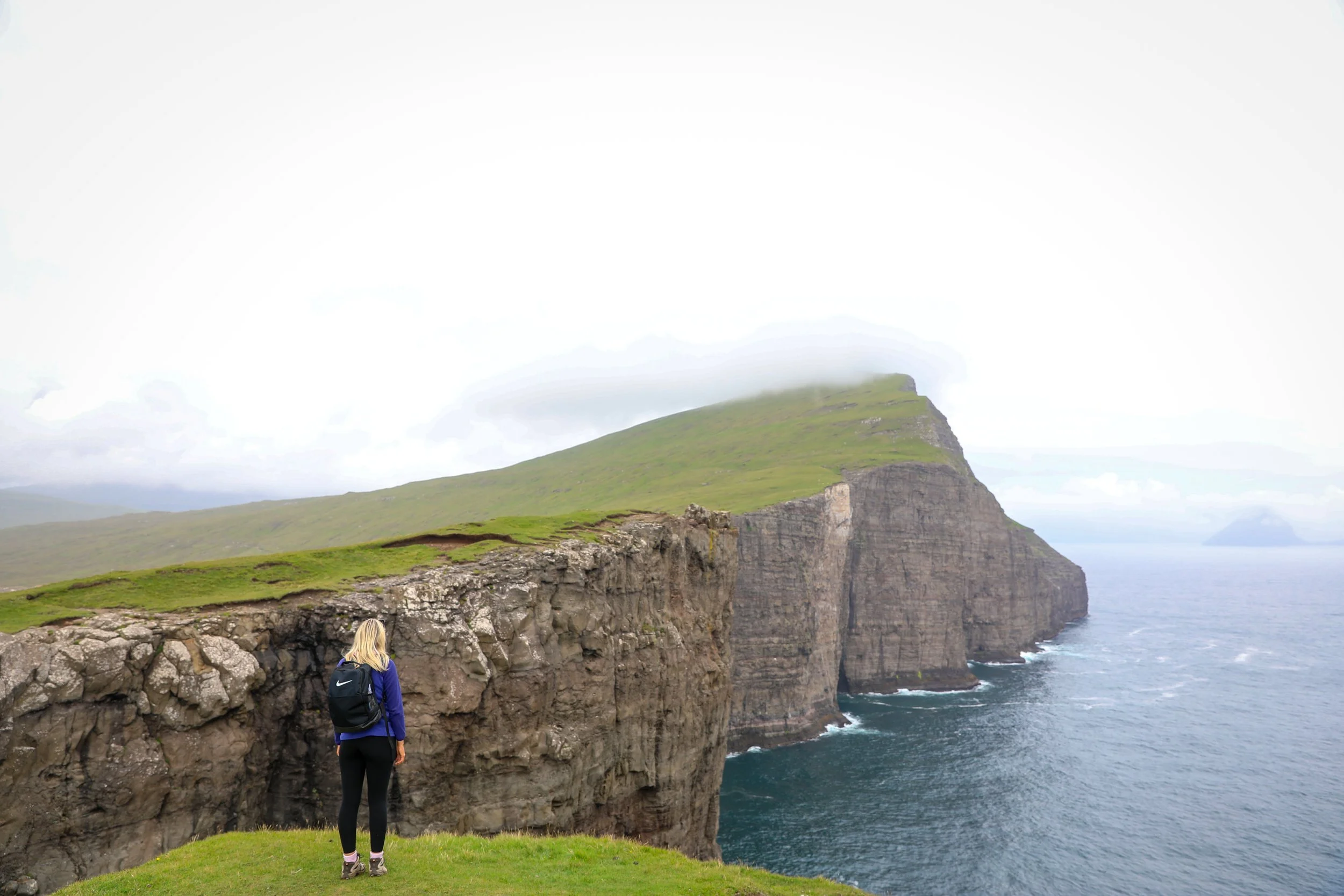
The Mýlingur hike is is a spectacular trail on Streymoy Island leading across dramatic sea cliffs and windswept ridgelines
Hikers are rewarded with breathtaking views of Sørvágsfjørður, Tindhólmur, and jagged sea stacks rising from the North Atlantic
Note that a large portion of the hike is completely unmarked, meaning that you need to be suitably prepared.
Next: Following on from the hike its a 44 minute drive back to Gjógv

Mýlingur Sea Cliffs
Day 5: Gjógv Village, Hvithamar Hike and Elduvík
Summary: Start the day in the village of Gjógv, then drive across Eysturoy to Funningur to complete the short and easy Hvíthamar hike, which leads to a scenic viewpoint overlooking Funningsfjørður Fjord. After the hike, continue on to the remote village of Elduvík, where you can wander the shoreline, enjoy peaceful fjord views, and soak in the quiet, untouched landscape before finishing the day.
Total Driving Distance: 60 km
Total Driving Duration: 2 hours
Accomodation: Klaksvík
Highlights: Views of Funningsfjørður Fjord, and visting the small Faroese villages of Gjógv and Elduvík.
Day 5 Overview:
Gjógv Village
Depart: Accomodation in Gjógv
Cost: Free entry
Gjógv’s iconic sea gorge forms a dramatic natural harbour where waves surge in from the North Atlantic and provides the village’s most striking views.
Short clifftop walks around the village lead to sweeping coastal panoramas, seabirds, and distant islands on clear days.
Traditional wooden houses with turf roofs and quiet lanes offer a glimpse into classic Faroese village life.
Gjógv Church and the nearby fishermen’s memorial reflect the village’s deep connection to the sea and its history.
Gjógv Village
Hvithamar Hike
Depart: Gjogv I Google Maps
Arrive: Hvithamar Carpark | Google Maps
Drive Distance: 3 km drive
Drive Duration: 5 minutes
Cost: Free entry
Hike Details
Trailhead: Signs adjacent carpark | Google Maps
Total Hiking Distance: 1.5 km | round-trip
Total Hiking Duration: 20 minute walk | one way
Difficulty: Easy
Altitude: 320 meters above sea level
The Hvithamar Hike is a scenic viewpoint rising above the village of Funningur on Eysturoy.
From the ridge, hikers are rewarded with panoramic views over Funningsfjørður Fjord and the tiny village of Elduvík nestled below.
Hvithamar Hike View
Elduvík Townsite
Depart: Hvithamar Carpark | Google Maps
Arrive: Elduvík Town I Google Maps
Drive Distance: 20 km drive
Drive Duration: 25 minutes
Cost: Free entry
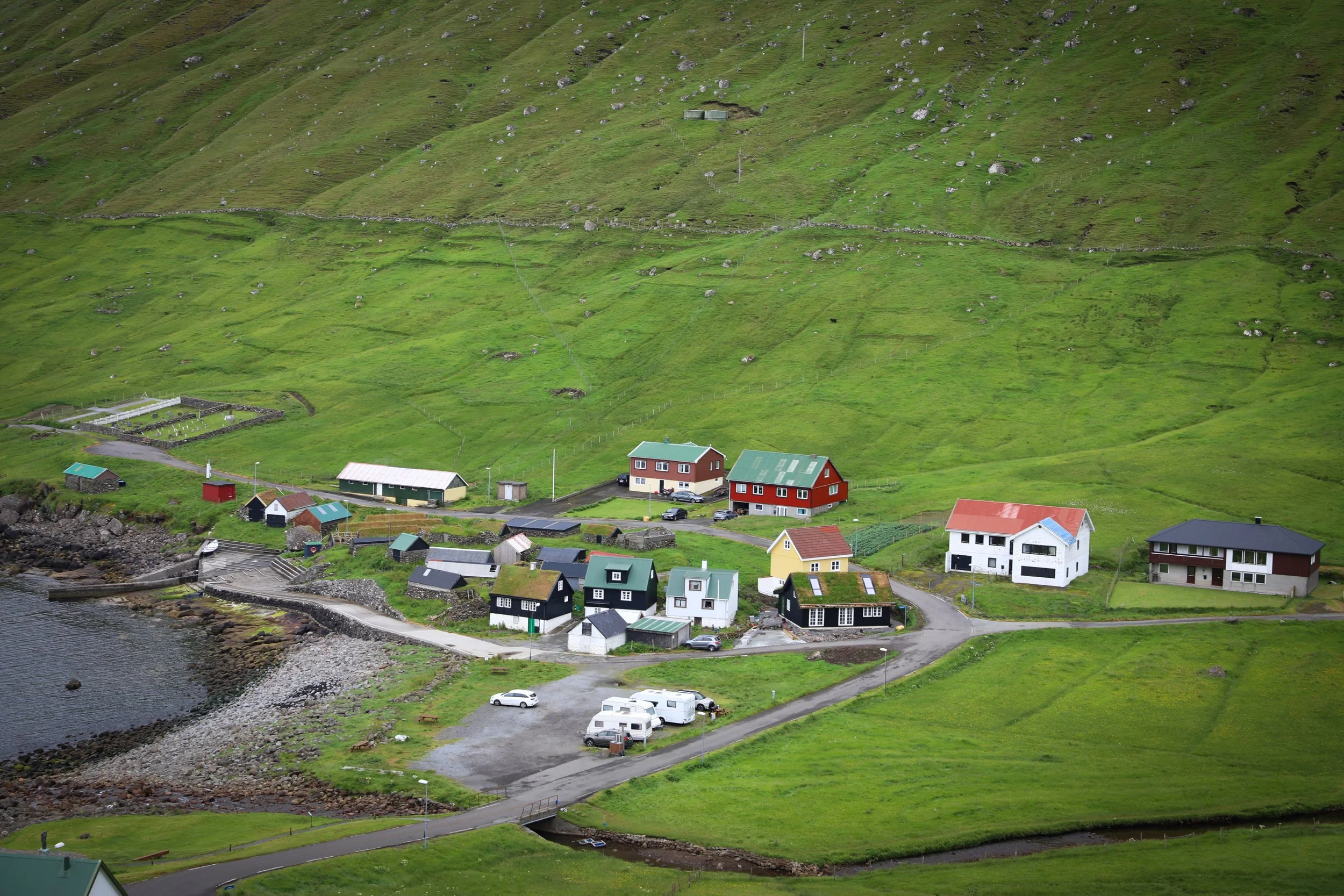
Elduvík is a tiny, remote village on Eysturoy set at the edge of Oyndarfjørður, surrounded by steep green mountains and rugged coastline.
The village offers peaceful fjord views and a raw, untamed shoreline where waves meet black basalt rock.
With no shops or tourist infrastructure, Elduvík feels untouched and is ideal for slow exploration, photography, and soaking in the Faroe Islands’ wild landscape.
Next: After your time in the town there 40 minute drive to Klaksvik where you will stay for the next two nights.
Elduvík Village
Day 6: Kalsoy Island and Kallur Lighthouse Hike
Summary: Depart from Klaksvík taking the ferry across to Syðradalur on Kalsoy Island. Once on the island, catch the local bus north to Trøllanes, travelling through Kalsoy’s narrow tunnels and dramatic mountain scenery. From Trøllanes, complete the iconic hike to Kallur Lighthouse, where sweeping views stretch across the North Atlantic to Kunoy, Eysturoy, and Viðoy. On the return journey, stop in the village of Mikladalur, home to the Seal Woman (Kópakonan) statue, before continuing back to Syðradalur for the ferry to Klaksvík, finishing the day back on Borðoy Island.
Total Driving Distance: no driving required
Total Driving Duration: no driving required
Accomodation: Klaksvik
Highlights: Visit Kalsoy Island, see the famous Kallur Lighthouse, as well as the Mikladalur Seal Woman
Day 6 Overview:
Kallur Lighthouse Hike
Transport Overview: To get to the island of Kalsoy you must take a ferry from Klasvik to Syðradalur (56 Klasvik - Kalsoy)
Depart: Klaksvik Ferry Port I Google Maps
Arrive: Syðradalur I Google Maps
Ferry Duration: 15 minutes
Ferry Tickets: can be purchased in advance on the Strandfaraskip Landsins website
Cost: Return trip without a vehicle is 105 DKK per adult
Public Bus: Once on the island you can get a bus, which aligns with the ferry timetable for around 100 DKK.
Bus Stops: The bus stops in only takes 10 minutes cover the entire island and stops in Mikladalur (Seal Woman Statue) and Trøllanes (Kallur)
Total Activity Duration: 5 hours
Hike Details
Trailhead: Follow signs from Trøllanes small townsite “Kallur” | Google Maps
Bus Stop: Town centre | Google Maps
Total Hiking Distance: 4.8 km | round trip
Total Hiking Duration: 1 hour hike | one way
Difficulty: Moderate
Altitude: 370 meters above sea level
Price: 200 DKK for Adults and 100 DKK for Children
The Kallur Lighthouse Hike is is one of the most iconic trails in the Faroe Islands, leading across grassy ridgelines and dramatic sea cliffs.
The path ends at a cliff-top lighthouse with sweeping views of Kunoy, Eysturoy, and Viðoy, offering a breathtaking panorama that captures the wild beauty of the North Atlantic.
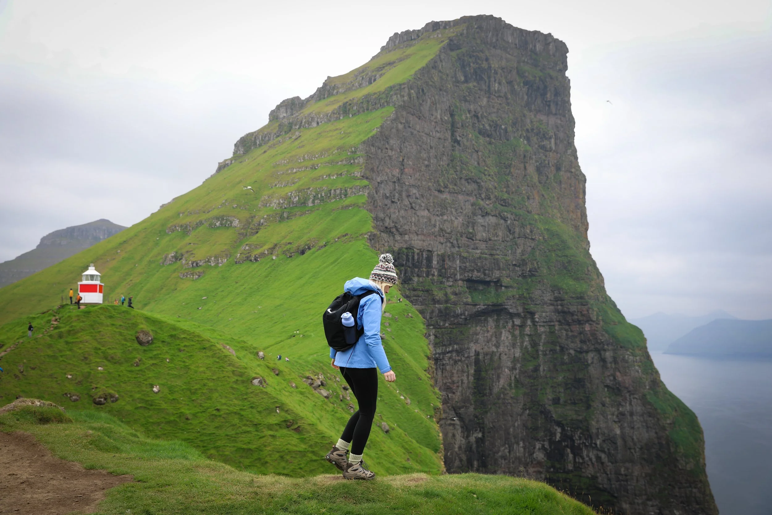
Kallur Lighthouse
Mikladalur Seal Woman Statue
Depart: Trøllanes | Google Maps
Arrive: Mikladalur I Google Maps
Bus Duration: 5 minutes
Cost: Free entry
Whilst still on the island of Kalsoy its worth stopping in the small town of Mikladalur to see the famous Seal Woman Statue.
The statue represents a Faroese legend in which seals shed their skins to become human on land, and one woman is forced to remain human after her skin is stolen.
Kópakonan symbolises themes of freedom, longing, and the deep relationship between Faroese folklore, the sea, and island life.
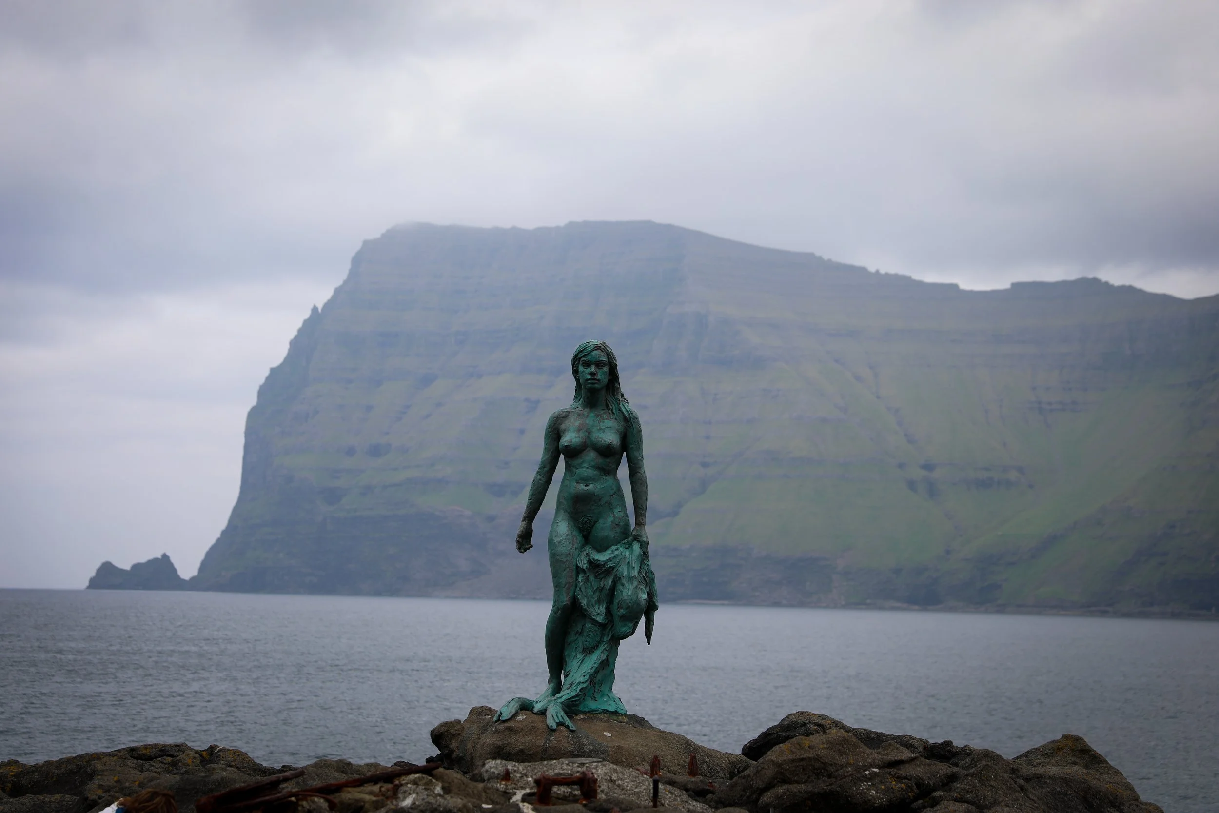
Mikladalur Seal Woman Statue
Day 7: Klakkur Hike and Tórshavn
Summary: depart from Mývatn early in the morning to head to Húsavík. Embark on a whale watching experience with North Sailing, offering potential sightings of humpback, minke whales. Afterwards, drive 35 minutes to Goðafoss, "Waterfall of the Gods," along the Skjálfandafljót River, ideal for a 1.5-hour visit with options to view the falls from multiple vantage points and enjoy lunch nearby. Finally, drive 30 minutes to Akureyri, Iceland’s second largest city.
Total Driving Distance: 114 km
Total Driving Duration: 1.5 hours
Accomodation: stay in Akureyri
Highlights: Whale watching in Húsavík and a visit to Goðafoss
Day 7 Overview:
Klakkur Hike
Depart: Klaksvik I Google Maps
Arrive: Klakkur upper parking location | Google Maps
Drive Distance: 4 km drive
Drive Duration: 10 minutes
Cost: Free entry
Hike Details
Trailhead: Follow signs from the carpark | Google Maps
Total Hiking Distance: 1.2 km | one-way
Total Hiking Duration: 35 minute walk | one way
Difficulty: Moderate
Altitude: 406 meters above sea level
Klakkur is a distinctive mountain rising above Klaksvík on Borðoy in the northern Faroe Islands.
Its rounded summit and steep grassy slopes create a natural lookout above the town, offering clear sightlines toward Kalsoy and the surrounding fjords.
Humpback Whale Tail
Tórshavn
Depart: Klakkur | Google Maps
Arrive: Tórshavn I Google Maps
Drive Distance: 43 km drive
Drive Duration: 50 minutes
Tórshavn is the capital of the Faroe Islands and the cultural and transport hub of the archipelago, set around a sheltered harbour on Streymoy Island.
The townsite includes Tinganes, Historic harbour area with red wooden buildings and narrow lanes; one of the oldest parliamentary sites in the world.
Skansin Fortress, Small historic fort and lighthouse with great views over Tórshavn harbour and nearby islands.
The Nordic House is a cultural centre showcasing Faroese and Nordic art, music, exhibitions, and events
Next: From here you can either extend your trip by going over to the island of Suðuroy or choose to fly out of Vagar Airport
Related Posts:
Discover the wild beauty of the Faroe Islands on an unforgettable 7-day self-drive itinerary. Begin on Vágar, chasing dramatic landscapes from the thundering Múlafossur Waterfall and the sculpted Drangarnir sea stacks to the optical illusion of Lake Leitisvatn hovering above the Atlantic. Venture offshore to Mykines for puffins and sweeping ocean views, then explore rugged coastal formations like Trøllkonufingur and Dúnnesdrangar. Cross to Streymoy to wander the grass-roofed village of Saksun and tackle the remote Mýlingur hike, before heading north to Borðoy and settling into Klaksvík. From here, journey to Kalsoy to hike to the iconic Kallur Lighthouse, perched high above sheer cliffs and endless sea, a fitting finale to one of the world’s most dramatic island road trips.